Burley, Washington facts for kids
Quick facts for kids
Burley, Washington
|
|
|---|---|
| Country | United States |
| State | Washington |
| County | Kitsap |
| Area | |
| • Total | 4.92 sq mi (12.73 km2) |
| • Land | 4.76 sq mi (12.34 km2) |
| • Water | 0.15 sq mi (0.39 km2) |
| Elevation | 33 ft (10 m) |
| Population
(2020)
|
|
| • Total | 2,081 |
| • Density | 423.39/sq mi (163.47/km2) |
| Time zone | UTC-8 (Pacific (PST)) |
| • Summer (DST) | UTC-7 (PDT) |
| ZIP code |
98322
|
| Area code(s) | 360 |
| FIPS code | 53-08885 |
| GNIS feature ID | 1512051 |
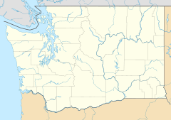
Burley is a small community in Kitsap County, Washington, United States. It's not a city with its own government, but it's a place where people live. It's located near the border with Pierce County. Burley is about halfway between the towns of Gig Harbor and Port Orchard. It sits at the top of Burley Lagoon, which is part of Henderson Bay. In 2020, about 2,081 people lived in Burley.
| Historical population | |||
|---|---|---|---|
| Census | Pop. | %± | |
| 2010 | 2,057 | — | |
| 2020 | 2,081 | 1.2% | |
| Sources: | |||
Contents
History of Burley
Burley was started in 1898 by a group called the Co-operative Brotherhood. They wanted to create a special community where people worked and lived together. This idea was part of a bigger plan to set up similar communities across Washington state. Another community like this, called Equality Colony, was started a year before Burley.
Early Days of the Community
When it was first founded, Burley was called "Brotherhood." There was even a part of the community called "Circle City," where buildings were arranged in a circle. At its busiest, about 150 people lived in Burley. However, like many planned communities from that time, the number of people living there slowly went down over the years.
Local Economy
The main business in Burley was the lumber industry. This means they cut down trees and processed wood. Other businesses didn't do as well. However, there was a short period when a company making cigars was successful.
Geography of Burley
Burley is located in the southern part of Kitsap County. To its south, it shares a border with the communities of Wauna and Purdy, which are in Pierce County.
Transportation and Area
Washington State Route 16 is a main road that goes through the eastern side of Burley. This road can take you north about 9 miles (14.5 km) to Port Orchard. If you go south on the same road, it's about 7 miles (11.3 km) to Gig Harbor. The total area of Burley is about 12.7 square kilometers (4.9 square miles). Most of this area, about 12.3 square kilometers (4.7 square miles), is land. The rest, about 0.4 square kilometers (0.15 square miles), is water.
See also
 In Spanish: Burley (Washington) para niños
 | Audre Lorde |
 | John Berry Meachum |
 | Ferdinand Lee Barnett |


