
Burwood Heights, New South Wales facts for kids
Quick facts for kids Burwood HeightsSydney, New South Wales |
|||||||||||||||
|---|---|---|---|---|---|---|---|---|---|---|---|---|---|---|---|

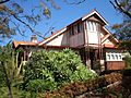
Federation house on Liverpool Road
|
|||||||||||||||
| Population | 989 (2016 census) | ||||||||||||||
| • Density | 3,300/km2 (8,500/sq mi) | ||||||||||||||
| Postcode(s) | 2136 | ||||||||||||||
| Elevation | 48 m (157 ft) | ||||||||||||||
| Area | 0.3 km2 (0.1 sq mi) | ||||||||||||||
| Location | 10 km (6 mi) W of Sydney CBD | ||||||||||||||
| LGA(s) | Municipality of Burwood | ||||||||||||||
| State electorate(s) | Strathfield | ||||||||||||||
| Federal Division(s) | Watson | ||||||||||||||
|
|||||||||||||||
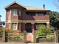
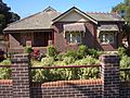
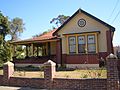
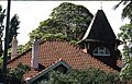
Burwood Heights is a quiet suburb in the Inner West area of Sydney, New South Wales, Australia. It's located about 10 kilometers west of the main Sydney city center. This area is part of the Municipality of Burwood, which is its local government.
Burwood Heights is mostly a place where people live. You won't find shops, schools, or big public buildings here. Its postcode is 2136, which is the same as the nearby suburb of Enfield. The suburb of Burwood is a separate area located to the north.
Contents
Discovering Burwood Heights: A Brief History
Burwood Heights officially became its own separate suburb on January 19, 2007. This decision was made by the Geographical Names Board of New South Wales. They are the group that names and defines places in New South Wales.
Who Lives Here? Burwood Heights Population
In 2016, a special count called the census showed that 989 people lived in Burwood Heights. More than half of these residents (51.7%) were born in Australia. The next largest group came from China (13.4%).
Languages Spoken at Home
When it comes to languages, 38.7% of people in Burwood Heights spoke only English at home. Many other languages were also spoken. These included Mandarin (12.6%) and Italian (10.1%). This shows that Burwood Heights is a diverse community.
Beliefs and Religions
The census also asked about people's religions. The most common answer was Catholic, with 33.8% of residents. Another 24.3% of people said they had no religion.
Images for kids
-
A quiet street in Burwood Heights
-
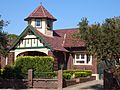
Homes in Burwood Heights
-
Houses along a tree-lined street
-
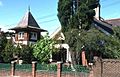
Possibly 70 Burwood Road Burwood Heights
-
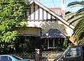
72 Liverpool Road Burwood Heights
-
74 Liverpool Road Burwood Heights
-
78 Liverpool Road Burwood Heights
-
Side view of 78 Liverpool Road
-
92 Liverpool Road Burwood Heights
-
Another view of 92 Liverpool Road


