Butler, Oklahoma facts for kids
Quick facts for kids
Butler, Oklahoma
|
|
|---|---|

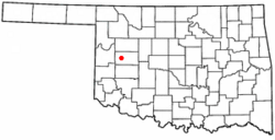
Location of Butler, Oklahoma
|
|
| Country | United States |
| State | Oklahoma |
| County | Custer |
| Area | |
| • Total | 0.43 sq mi (1.10 km2) |
| • Land | 0.43 sq mi (1.10 km2) |
| • Water | 0.00 sq mi (0.00 km2) |
| Elevation | 1,768 ft (539 m) |
| Population
(2020)
|
|
| • Total | 208 |
| • Density | 488.26/sq mi (188.64/km2) |
| Time zone | UTC-6 (Central (CST)) |
| • Summer (DST) | UTC-5 (CDT) |
| ZIP code |
73625
|
| Area code(s) | 580 |
| FIPS code | 40-10450 |
| GNIS feature ID | 2411749 |
Butler is a small town located in Custer County, Oklahoma, in the United States. It is a quiet place where people live and work. In 2020, about 208 people called Butler home. This number was a bit smaller than in 2010, when 287 people lived there.
Where is Butler Located?
Butler is found in the western part of Custer County. It sits right where two state highways meet: Highway 33 and Highway 44.
- Highway 33 goes west about 11 miles to Hammon.
- Highway 33 also goes east about 12 miles to U.S. Route 183. From there, you can go south about 8.5 miles to Clinton, which is the main city in Custer County.
- Highway 44 goes south from Butler about 14 miles to Foss and Interstate 40.
The United States Census Bureau says that Butler covers a total area of about 1.1 square miles (2.6 square kilometers), and all of it is land. A place called Foss Reservoir is located about 5 miles south of Butler.
Butler's Weather
The weather in Butler, Oklahoma, changes throughout the year. Here's a quick look at the average temperatures and rainfall:
| Climate data for Butler, Oklahoma | |||||||||||||
|---|---|---|---|---|---|---|---|---|---|---|---|---|---|
| Month | Jan | Feb | Mar | Apr | May | Jun | Jul | Aug | Sep | Oct | Nov | Dec | Year |
| Mean daily maximum °F (°C) | 47.8 (8.8) |
53.1 (11.7) |
62.2 (16.8) |
72.9 (22.7) |
80.5 (26.9) |
89.4 (31.9) |
95.6 (35.3) |
93.3 (34.1) |
84.6 (29.2) |
74.4 (23.6) |
60.2 (15.7) |
49.9 (9.9) |
72.0 (22.2) |
| Mean daily minimum °F (°C) | 19.1 (−7.2) |
24.4 (−4.2) |
32.6 (0.3) |
44.1 (6.7) |
53.3 (11.8) |
63.5 (17.5) |
68.4 (20.2) |
66.5 (19.2) |
57.9 (14.4) |
44.6 (7.0) |
32.6 (0.3) |
22.4 (−5.3) |
44.1 (6.7) |
| Average precipitation inches (mm) | 0.7 (18) |
1.1 (28) |
1.9 (48) |
2.0 (51) |
4.2 (110) |
3.8 (97) |
2.0 (51) |
3.0 (76) |
3.1 (79) |
2.0 (51) |
1.6 (41) |
0.8 (20) |
26.2 (670) |
| Source: Weatherbase.com | |||||||||||||
People in Butler
The number of people living in Butler has changed over the years. Here's how the population has looked during different census counts:
| Historical population | |||
|---|---|---|---|
| Census | Pop. | %± | |
| 1920 | 332 | — | |
| 1930 | 473 | 42.5% | |
| 1940 | 428 | −9.5% | |
| 1950 | 351 | −18.0% | |
| 1960 | 351 | 0.0% | |
| 1970 | 315 | −10.3% | |
| 1980 | 388 | 23.2% | |
| 1990 | 341 | −12.1% | |
| 2000 | 345 | 1.2% | |
| 2010 | 287 | −16.8% | |
| 2020 | 208 | −27.5% | |
| U.S. Decennial Census | |||
In 2000, there were 345 people living in Butler. They lived in 138 different homes, and 104 of those were families. The average number of people in a home was about 2.5.
The people in Butler were of different ages:
- About 24% were under 18 years old.
- About 7% were between 18 and 24 years old.
- About 25% were between 25 and 44 years old.
- About 27% were between 45 and 64 years old.
- About 16% were 65 years old or older.
The average age of people in Butler in 2000 was 40 years.
Schools in Butler
Today, students in Butler attend schools that are part of the Arapaho Public Schools district.
There used to be a separate school district just for Butler. In 1989, about 180 students were enrolled in the Butler school district. In 2008, the leaders of the Butler school district decided to join with the Arapaho school district. This merger happened that same year.
See also
 In Spanish: Butler (Oklahoma) para niños
 | Delilah Pierce |
 | Gordon Parks |
 | Augusta Savage |
 | Charles Ethan Porter |

