Butt of Lewis facts for kids
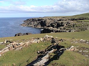
The Butt of Lewis (which in Scottish Gaelic is Rubha Robhanais) is the very northern tip of Lewis, a large island in the Outer Hebrides of Scotland. This wild and windy place sticks out into the Atlantic Ocean. It's often hit by big waves and strong storms. A tall lighthouse stands there to guide ships safely past. The closest village is Eoropie, about 1 mile (1.6 km) to the south.
What is the Butt of Lewis?
The Butt of Lewis is a famous headland, which is a piece of land that sticks out into the sea. It's known for its dramatic cliffs and powerful ocean views. This area is a key landmark for sailors and a popular spot for visitors. It shows off the rugged beauty of Scotland's islands.
Location and Landscape
To reach the lighthouse, you'll travel along a road that passes Port Stoth. This is a small, sheltered bay. Along the coast, you can also see old farm fields called "lazy beds." These are long, narrow mounds of soil where crops were once grown. They show how people used to farm in this area.
Amazing Ancient Rocks
The Butt of Lewis is home to some of the oldest rocks in all of Europe! These incredible rocks formed during a time called the Precambrian supereon. This was a very, very long time ago, almost 3,000 million years ago. Imagine rocks that have been around for billions of years! They tell a story of Earth's ancient past.
Natural Wonders
Southwest of the lighthouse, there's a cool natural arch called the "Eye of the Butt" (in Gaelic, Sùil an Rubha). A natural arch is a rock formation that looks like a bridge or an archway, carved out by the sea and wind. The best place to see this arch is from the Habost machair. A machair is a special type of fertile grassland found only on the west coasts of Scotland and Ireland.
 | John T. Biggers |
 | Thomas Blackshear |
 | Mark Bradford |
 | Beverly Buchanan |


