Eoropie facts for kids
Quick facts for kids Eoropie
|
|
|---|---|
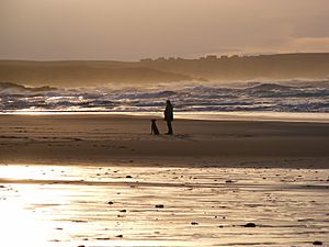
 The beach at Eoropie |
|
| Language | Scottish Gaelic English |
| OS grid reference | NB515650 |
| Civil parish | |
| Council area | |
| Lieutenancy area | |
| Country | Scotland |
| Sovereign state | United Kingdom |
| Post town | STORNOWAY |
| Postcode district | HS2 |
| Dialling code | 01851 |
| Police | Northern |
| Fire | Highlands and Islands |
| Ambulance | Scottish |
| EU Parliament | Scotland |
| UK Parliament |
|
| Scottish Parliament |
|
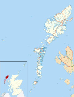
Eoropie (Scottish Gaelic: Eòrapaidh) is a small village located at the very northern tip of the Isle of Lewis in Scotland. It's part of the Ness area within the Outer Hebrides. Eoropie is also found in the larger parish of Barvas.
This village is famous for its historic Teampull Mholuaidh church. You can find Eoropie at the end of two roads, the B8013 and B8014, which connect it to Lionel and Port of Ness. Eoropie is just south of the Butt of Lewis, which is the most northerly point of the island. The village is also home to the fun Eoropie Dunes Park.
Contents
Exploring Eoropie's Special Places
Ancient Churches: Teampall Rònaidh
In Eoropie, you can find the remains of Teampall Rònaidh. This old chapel is a protected ancient site, meaning it's very important historically. People believe it might be the oldest church site in Northern Lewis.
Local stories connect this place to the island of North Rona. One legend says that a saint named Ronan was carried from Ness to North Rona on the back of a sea monster! It's also said that a person named Rònaidh built this chapel and lived there with his sister.
Teampall Mholuaidh: A Restored Church
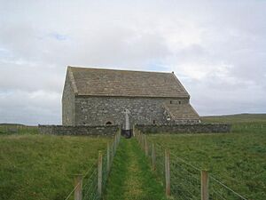
Another very old church in Eoropie is Teampall Mholuaidh, also known as St Moluag's. This church might have been built a long time ago, possibly between the 12th and 16th centuries. For many years, it didn't have a roof and was even used as a shelter for sheep!
However, in 1912, the church was carefully restored. Today, it is a Scottish Episcopal Church, meaning it's still used for worship. Traditionally, this church is thought to be the special church of the MacLeod family.
Eoropie Beach: Sand and Sea
Eoropie is home to a beautiful, wide sandy beach. It's located right on the edge of the village, offering a great place to enjoy the sea and sand.
Eoropie Dunes Park: Fun for Everyone
The Eoropie Dunes Park is a fantastic four-acre play area in the village. It's managed by a charity called Guth Airson Iarrtasan Nis, which means "A Voice for the Needs of Ness."
This park was created in 1998 by a group of mothers who wanted a local playground for their children. Their goal was "to enhance play and leisure facilities and encourage environmental awareness." The land for the park was kindly given by the local farming families, known as crofting families, who traditionally worked the sandy land along the west coast of Lewis.
 | Charles R. Drew |
 | Benjamin Banneker |
 | Jane C. Wright |
 | Roger Arliner Young |


