Butte Creek (Oregon) facts for kids
Quick facts for kids Butte Creek |
|
|---|---|

|
|
|
Location of the mouth of Butte Creek in Oregon
|
|
| Country | United States |
| State | Oregon |
| County | Marion, Clackamas |
| Physical characteristics | |
| Main source | Cascade Range Butte Basin, Santiam State Forest, Marion County, Oregon 3,550 ft (1,080 m) 44°53′06″N 122°23′55″W / 44.88500°N 122.39861°W |
| River mouth | Pudding River near Woodburn, Clackamas County, Oregon 102 ft (31 m) 45°09′38″N 122°46′23″W / 45.16056°N 122.77306°W |
| Length | 33 mi (53 km) |
| Basin features | |
| Basin size | 69 sq mi (180 km2) |
Butte Creek is a stream in the U.S. state of Oregon. It is a branch, or tributary, of the Pudding River. The creek is about 33 miles (53 kilometers) long. For its entire journey, Butte Creek helps define the border between Marion County and Clackamas County.
Journey of Butte Creek
Butte Creek starts high up in the Cascade Range mountains. Its source is a remote area called Butte Basin, located in the Santiam State Forest. This is about 8 miles (13 kilometers) north of Gates. In Butte Basin, you can find Copper Lake and Butte Lakes.
The creek begins by flowing mostly northwest. It travels through steep mountains and thick forests for about two-thirds of its length. Along the way, it picks up water from smaller streams like Camp Creek and Fill Creek.
As it continues, Butte Creek turns west for a short distance. Here, it runs alongside South Gawley Ridge. It also receives water from Rhody Creek, which drains Rhody Lake, and Fibre Creek, which drains Fibre Lake. Soon after, it turns back to a northwesterly direction.
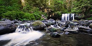
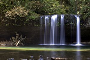
One of the most notable spots along the creek is Butte Creek Falls. The water drops over these falls about halfway through its journey. After the falls, the creek flows through a forest canyon. This canyon gradually widens into a gentle valley.
Further downstream, Butte Creek turns northward for several miles. The land around the creek changes from thick forest to areas with farms and private forests. Many small, unnamed creeks join Butte Creek as it flows.
Near Scotts Mills, the creek passes a dam. It continues to flow gently through rolling hills. The hills here are not very high, usually less than 200 feet (61 meters).
Near Monitor, there is a station that measures the river's flow. Closer to its end, Butte Creek passes under Oregon Route 211. Finally, Butte Creek flows into the Pudding River near Woodburn. The mouth of the creek is about 6 miles (10 kilometers) north of Mt. Angel.
 | Sharif Bey |
 | Hale Woodruff |
 | Richmond Barthé |
 | Purvis Young |


