Béhorléguy facts for kids
Quick facts for kids
Béhorléguy
Behorlegi
|
||
|---|---|---|
 |
||
|
||
| Country | France | |
| Region | Nouvelle-Aquitaine | |
| Department | Pyrénées-Atlantiques | |
| Arrondissement | Bayonne | |
| Canton | Montagne Basque | |
| Intercommunality | Pays Basque | |
| Area
1
|
20.58 km2 (7.95 sq mi) | |
| Population
(Jan. 2019)
|
73 | |
| • Density | 3.547/km2 (9.19/sq mi) | |
| Time zone | UTC+01:00 (CET) | |
| • Summer (DST) | UTC+02:00 (CEST) | |
| INSEE/Postal code |
64107 /64220
|
|
| Elevation | 299–1,267 m (981–4,157 ft) (avg. 694 m or 2,277 ft) |
|
| 1 French Land Register data, which excludes lakes, ponds, glaciers > 1 km2 (0.386 sq mi or 247 acres) and river estuaries. | ||
Béhorléguy is a small village, also called a commune, located in the southwestern part of France. It is found in the Pyrénées-Atlantiques département, which is like a county or administrative area in France. This charming place is known for its quiet, rural setting and beautiful natural surroundings.
About Béhorléguy
Béhorléguy is a very small commune with a population of about 73 people as of January 2019. It is part of the Pyrénées-Atlantiques département, which is in the Nouvelle-Aquitaine region of France. The name of the commune in the local Basque language is Behorlegi.
Where is Béhorléguy?
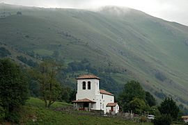
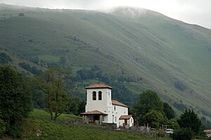
Béhorléguy is nestled in the Pyrenees mountains, close to the border with Spain. Its location in the Lower Navarre area means it has strong ties to Basque culture. The village is part of the Bayonne arrondissement and the Montagne Basque canton, which are smaller administrative divisions.
Geography and Nature
The commune of Béhorléguy covers an area of about 20.58 square kilometers (about 7.95 square miles). Its elevation varies quite a lot because it's in a mountainous area. The lowest point is 299 meters (981 feet) above sea level, and the highest point reaches 1267 meters (4157 feet). This diverse landscape includes valleys, hills, and mountain peaks.
The natural environment around Béhorléguy is very important. It features green pastures, forests, and clear streams. This makes it a great place for outdoor activities like hiking and exploring nature. The area is home to various types of plants and animals typical of the Pyrenees region.
Life in Béhorléguy
Life in Béhorléguy is peaceful and connected to nature. The small population means that people often know each other well, creating a strong community feeling. The local economy is mainly based on farming and traditional activities.
The mayor of Béhorléguy is Pascal Néguelouart, who has been serving since 2020. He will continue his term until 2026. The commune is also part of the Pays Basque intercommunality, which is a group of communes that work together on shared projects and services.
See also
 In Spanish: Béhorléguy para niños
 | Laphonza Butler |
 | Daisy Bates |
 | Elizabeth Piper Ensley |


