Côte-Saint-Paul facts for kids
Quick facts for kids
Côte-Saint-Paul
|
|
|---|---|

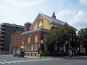
Former City Hall
|
|
| Country | Canada |
| Province | Quebec |
| City | Montreal |
| Borough | Le Sud-Ouest |
| Population
(2011)
|
|
| • Total | 11,720 |
Côte-Saint-Paul is a neighbourhood in Montreal, Quebec, Canada. It's part of the Southwest Borough of the city.
Contents
History of Côte-Saint-Paul
The land of Côte-Saint-Paul was first given out by the Sulpician Order in 1662. The Sulpicians were like the landlords of the Island of Montreal back then. This area was mostly used for farming for a long time.
From Farmland to Factories
Things started to change when the Lachine Canal was built in 1825. This canal cut through the area and provided water power for factories. Workers began to move in, creating a small community. The village of Côte-Saint-Paul was officially started in 1874. Soon after, a church, a town hall, and a railway station were built.
In 1878, the western part of the village became its own separate area called Ville-Émard. The rest of the village of Côte-Saint-Paul became a town in 1894 and was renamed Saint-Paul in 1897.
Joining Montreal
In 1910, Saint-Paul joined the city of Montreal, just like its neighbour Ville-Émard. More factories and houses were built, and the remaining farmland disappeared.
However, the area faced challenges when the Saint Lawrence Seaway was built. This new seaway meant less ship traffic on the Lachine Canal, which hurt the local industries. In 1964, the construction of the Décarie Expressway and the Turcot Interchange cut right through the old heart of Saint-Paul. Luckily, important buildings along Avenue de l'Église were saved.
Good news came in 1978 when the Montreal Metro subway system reached Côte-Saint-Paul. The Jolicoeur metro station opened, making it easier for people to travel.
Today, Côte-Saint-Paul is part of the Le Sud-Ouest borough of Montreal. Its western border is a bit wider now than it was when it was an independent town.
Geography of Côte-Saint-Paul
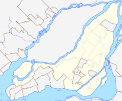
Côte-Saint-Paul is located in the southwest part of Montreal.
- To the south, it's bordered by Desmarchais Boulevard.
- To the west, it's bordered by Monk Boulevard.
- To the east, you'll find the aqueduct.
- To the north, it's next to the Lachine Canal and the railway tracks near Pointe-Saint-Charles.
You can get to Côte-Saint-Paul using the De La Vérendrye exit on Quebec Autoroute 15.
Infrastructure and Recreation
The neighbourhood has good transportation and green spaces.
- The Jolicoeur Montreal Metro station serves the area, making it easy to get around the city.
- The neighbourhood is also crossed by the Lachine Canal and the Aqueduct Canal.
- For fun and exercise, residents can visit Parc de La Vérendrye and Parc Saint-Paul.
- There are also bicycle paths along the Aqueduct and Lachine Canals. These paths are connected through the industrial area east of the Décarie Expressway.
 | Lonnie Johnson |
 | Granville Woods |
 | Lewis Howard Latimer |
 | James West |


