Cairnie Hill facts for kids
Quick facts for kids Cairnie Hill |
|
|---|---|

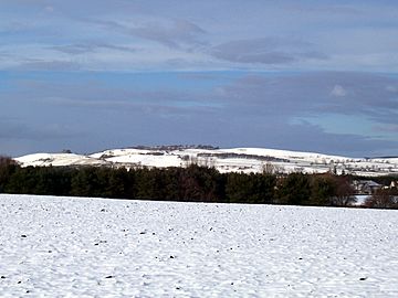
Cairnie Hill from the Howe of Fife
|
|
| Highest point | |
| Elevation | 228 m (748 ft) |
| Prominence | 150 m (490 ft) |
| Listing | Marilyn |
| Geography | |
|
Lua error in Module:Location_map at line 420: attempt to index field 'wikibase' (a nil value).
|
|
| Parent range | Ochil Hills |
| OS grid | NO279155 |
| Topo map | OS Landranger 59 |
Cairnie Hill is a lovely hill located in Fife, Scotland. It's part of the eastern Ochil Hills range. This hill stands proudly above the small village of Collessie. It's a great spot for exploring the Scottish countryside.
Exploring Cairnie Hill
Where is Cairnie Hill?
Cairnie Hill is found in the beautiful region of Fife, Scotland. It's at the very eastern end of the Ochil Hills. The hill rises above the village of Collessie. It's the highest point in a small area. This area is between Collesie Den and Collairnie Farm.
The northern and western sides of Cairnie Hill are quite steep. These slopes are used for rough grazing. This means animals like sheep eat the wild grasses there. Some parts are also used for forestry. This is where trees are grown for wood.
To the south, the land rises gently. This area is known as the Howe of Fife. It is mostly used for arable farming. This means farmers grow crops like wheat or barley.
What's in a Name?
The name "Cairnie" is quite common in Fife. It might come from an old language called Pictish. The word "Carden" in Pictish meant "thicket." A thicket is a dense group of bushes or trees.
The name might also have a Gaelic ending. The ending "aigh" was often added to place names. Another idea is that "Cairnie" is a Scots word. In Scots, it means a "hillock." A hillock is a small hill. So, the name simply means "little hill."
Reaching the Top
Cairnie Hill is not too difficult to climb. There is an easy path to the summit. You can start your walk from a specific point. This point is at grid reference NO 273153. It's on the B937 road. This spot is about 2 kilometers south of Lindores.
From this starting point, a track leads upwards. This track takes you towards the summit area. Once you are near the top, you will find several paths. These paths will guide you right to the very summit. From the top, you can enjoy great views of the surrounding area.
 | Shirley Ann Jackson |
 | Garett Morgan |
 | J. Ernest Wilkins Jr. |
 | Elijah McCoy |

