Caistor Canal facts for kids
The Caistor Canal was a waterway built in Lincolnshire, England. It was about 4 miles (6.4 km) long. People built it between 1793 and 1798.
The canal connected to the River Ancholme. It ran towards Caistor but stopped at Moortown. This was about 3.5 miles (5.6 km) short of Caistor. The canal had six special gates called locks. It stopped being used after 1850. In 1936, it was officially closed down. Some parts of it were dug out again in 2010. This helped to prevent floods in South Kelsey.
Contents
History of the Caistor Canal
Water travel in the River Ancholme area got better around 1767. People thought of building the Caistor Canal in 1792. It would help boats reach the market town of Caistor. This town was about 8 miles (13 km) to the east.
Planning the Canal
A meeting happened in July 1792 to discuss the idea. They asked a canal expert, William Jessop, to check the plan. The Ancholme Navigation Commissioners looked at his report. They wanted to make sure the canal would not cause floods. They agreed to the plan.
A special law, called an Act of Parliament, was passed on June 3, 1793. This law allowed the canal to be built. It also created the Caistor Canal Navigation Company. This company could raise money to build the canal. Robert Dickinson was the engineer for the project.
Building and Challenges
The canal was planned to have six locks. These locks would lower the water level by 42 feet (13 m). The law said the canal should go all the way to Caistor. A road was even built from Caistor to where the canal basin would be.
However, the canal only reached Moortown. It opened in 1800. It is thought that money problems stopped it from going further. The company borrowed £4,600 from Francis Foljambe. He was a main supporter and owned much of the land.
The money from tolls (fees to use the canal) was not enough. It could not even pay the interest on the loan. By 1813, the company owed £574 in unpaid interest. There are no records showing the loan was ever paid back.
Plans for Extension
Soon after the canal opened, people wanted to extend it. In May 1801, the Canal Company announced plans. They wanted to build a canal from Moortown to Hambleton Hill. This was near Market Rasen.
William Dixon, a local landowner, paid for a survey. It showed the extension would cost about £6,500. Many local gentlemen met in Market Rasen. They agreed to go ahead with the plans. They planned another meeting, but it seems nothing more happened.
Decline and Closure
The canal likely stopped being used in the 1850s. This was a few years after a railway opened near Caistor. Some boats might have still gone to South Kelsey for a while.
Over time, parts of the canal were used for other things. For example, Mill Lock, the fourth lock, became a watermill. The mill wheel was in the lock chamber. This mill was built in the 1870s but stopped being used by 1914. All signs of it are now gone.
The canal became dry above the fifth lock. The stones of the sixth lock were removed before 1883. After all boats stopped using the canal, small dams were built across the lower locks. The canal and its drainage system fell into disrepair.
In 1936, the Ancholme drainage authority took over the canal. This was to help with drainage in the area. A special order officially closed the canal for navigation.
The Caistor Canal was a "broad canal." Its locks were 60 feet (18 m) long and 14 feet (4.3 m) wide. This size was good for the large boats called Humber Keels. These boats were used on many waterways connected to the Humber.
The Caistor Canal Today
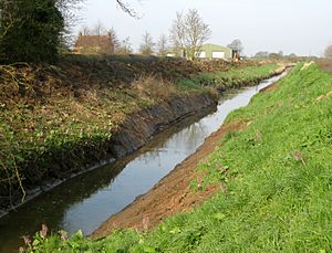
Today, you cannot travel by boat on the Caistor Canal. The Environment Agency now looks after it. They use it as a main channel for draining water.
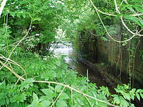
The remains of the lower five lock chambers are still there. Also, the parts that supported the tow-path bridge are still visible. These structures are now "grade II listed." This means they are protected because they are historically important. Even though it's closed, two small boats managed to reach the first lock in 2002.
Flood Prevention Efforts
In 2007, homes in South Kelsey experienced flooding. To help prevent this, the Environment Agency worked on the canal. In March 2010, they dug out part of the canal. This made it deeper again.
About 1 mile (1.6 km) of the canal bed was affected. This was between the locks on either side of South Kelsey village. This work helps the canal hold more water. It also lowers the risk of future floods.
Several sand bars had formed in the channel. These were removed during the project. Experts helped with the work. They made sure that the water voles (small animals living near water) were not harmed.
Route of the Canal
| Point | Coordinates (Links to map resources) |
OS Grid Ref | Notes |
|---|---|---|---|
| Junction with River Ancholme | 53°28′44″N 0°28′44″W / 53.478890°N 0.479°W | TF010989 | Start of canal |
| Ings lock | 53°28′39″N 0°26′56″W / 53.4774°N 0.4489°W | TF030989 | |
| Willow lock | 53°28′39″N 0°26′30″W / 53.4776°N 0.4417°W | TF035990 | |
| South Kelsey bridge | 53°28′37″N 0°25′52″W / 53.477°N 0.431°W | TF042989 | basin on east side |
| Mill Lock | 53°28′26″N 0°25′08″W / 53.474°N 0.419°W | TF050986 | |
| Moor Lock | 53°28′19″N 0°24′29″W / 53.472°N 0.408°W | TF057985 | |
| Moortown wharf and lock | 53°28′38″N 0°23′21″W / 53.4772°N 0.3892°W | TF070990 | End of canal |
 | Bayard Rustin |
 | Jeannette Carter |
 | Jeremiah A. Brown |


