Caldwell Creek (Pennsylvania) facts for kids
Quick facts for kids Caldwell Creek |
|
|---|---|
|
Location of Caldwell Creek mouth
|
|
| Other name(s) | Tributary to Pine Creek |
| Country | United States |
| State | Pennsylvania |
| County | Warren Crawford |
| Physical characteristics | |
| Main source | divide between Caldwell Creek, Gar Run, and Tidioute Creek Pittsfield Township, Warren County, Pennsylvania 1,720 ft (520 m) 41°46′03″N 79°27′35″W / 41.76750°N 79.45972°W |
| River mouth | Pine Creek Eldred Township, Warren County, Pennsylvania 1,192 ft (363 m) 41°41′37″N 79°34′10″W / 41.69361°N 79.56944°W |
| Length | 15.28 mi (24.59 km) |
| Basin features | |
| Progression | generally south |
| River system | Allegheny River (Oil Creek) |
| Basin size | 47.24 square miles (122.4 km2) |
| Tributaries |
|
| Bridges | Tidioute Creek Road, PA 27, Sanford Road, Eldred Center Road, Selkirk Road, Dotyville Hill Road, Duncan Road |
Caldwell Creek is a stream in Pennsylvania, United States. It flows into Pine Creek. This makes Caldwell Creek a tributary of Pine Creek. A tributary is a smaller stream or river that flows into a larger one. Caldwell Creek is located in Warren County and Crawford County.
Contents
Where Does Caldwell Creek Start?
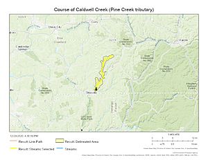
Caldwell Creek begins in Warren County. Its source is about half a mile south of a place called Torpedo, Pennsylvania. The stream starts at an elevation of about 1,720 feet (524 meters) above sea level.
How Does Caldwell Creek Flow?
After starting in Warren County, Caldwell Creek flows generally south. It travels through both Warren County and Crawford County. The creek eventually joins Pine Creek. This meeting point is about one mile northeast of East Titusville, Pennsylvania. At this point, the elevation is about 1,192 feet (363 meters).
What is the Caldwell Creek Watershed?
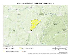
A watershed is an area of land where all the water drains into a single stream, river, or lake. The Caldwell Creek watershed covers about 47.24 square miles (122.3 square kilometers). This area gets about 44.7 inches (113.5 cm) of rain each year. About 75% of the land in this watershed is covered by forests.
Other Names for Caldwell Creek
Historically, Caldwell Creek has also been known by another name:
- East Branch Caldwell Creek
Maps of Caldwell Creek
Here are some maps that show Caldwell Creek and its surrounding area.


