California Historical Landmarks in Fresno County facts for kids
This article is about some really cool historical places in Fresno County, California, a part of Northern California. These places are so important that they've been named California Historical Landmarks. Think of them as special spots that tell us stories about the past!
Exploring Fresno County's History
Fresno County is full of interesting history, from old forts to special gardens and important moments in social justice. Let's take a closer look at some of these amazing landmarks.
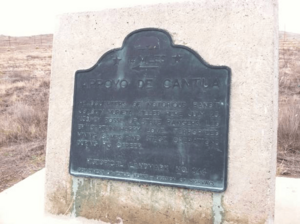
Arroyo de Cantúa (Cantua Creek)
This landmark, known as Arroyo de Cantúa, is located near Coalinga. It's a significant spot because it's connected to the history of the area, including stories from the past that shaped California. You can find it where Dorris Avenue meets State Highway 33.
Forestiere Underground Gardens
Imagine living underground to escape the hot California sun! That's what Baldassare Forestiere did. He built the amazing Forestiere Underground Gardens in Fresno. This incredible place has tunnels, courtyards, and even rooms all built by hand, underground. It's also recognized on the National Register of Historic Places, which means it's super important for its history and unique design. You can visit these gardens at 5021 West Shaw Avenue.
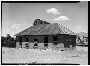
Fort Miller
Near Friant, within the Millerton Lake State Recreation Area, you'll find the site of Fort Miller. This was once an important military post in California's early history. It played a role in the development of the region and is a reminder of the frontier times.
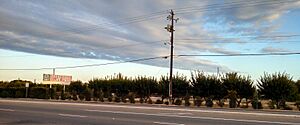
Fresno City (Old Town)
The original Fresno City was located near the Fresno Slough in what is now Tranquillity. This was the first settlement in the area to be called Fresno City, even before the modern city of Fresno was established. It's a historical reminder of where the region's story truly began.
Fresno Free Speech Fight
In Fresno, at Mariposa Street and Congo Alley, is the site of the Fresno Free Speech Fight. This was a very important event in the early 1900s where people stood up for their right to speak freely and organize. It's a significant part of California's history of workers' rights and freedom of expression.
California's First Junior College
Fresno City College in Fresno holds a special place in educational history. It's recognized as the site of the first junior college in California. This means it was a pioneer in offering higher education beyond high school, helping many students continue their learning journey. You can find this historic spot at Stanislaus Street and O Street.
Temporary Detention Camps for Japanese Americans
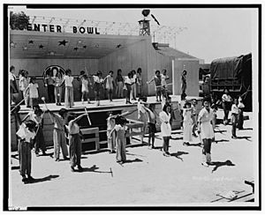
During World War II, two sites in Fresno County were used as Temporary Detention Camps for Japanese Americans. These were places where Japanese Americans, including many children and families, were held after the attack on Pearl Harbor, even though they had done nothing wrong.
Fresno Assembly Center
One of these centers was at the Big Fresno Fairgrounds in Fresno. This site, known as the Fresno Assembly Center, was a temporary holding place before people were moved to larger, more permanent camps.
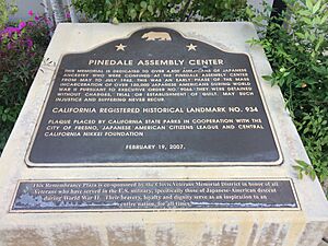
Pinedale Assembly Center
The other site was the Pinedale Assembly Center in Pinedale, located at 650 West Alluvial Avenue. Like the Fresno center, it was a temporary camp where Japanese Americans were held during a difficult time in American history. These sites serve as important reminders of the need for justice and civil rights for everyone.
Images for kids
 | Jessica Watkins |
 | Robert Henry Lawrence Jr. |
 | Mae Jemison |
 | Sian Proctor |
 | Guion Bluford |


