California Historical Landmarks in Modoc County facts for kids
Modoc County, located in northeastern California, is a place rich in history, especially for understanding the early days of California and the lives of Native American tribes and pioneers. Many important places in Modoc County are recognized as California Historical Landmarks. These landmarks help us remember and learn about the past.
This article will take you on a journey through some of these special historical sites in Modoc County. You'll discover places where important events happened, like battles, trading posts, and significant trails that people used long ago.
Contents
Discovering Modoc County's Past
Modoc County holds many secrets and stories from California's history. These landmarks are like open-air museums, showing us where significant events took place. They remind us of the challenges and changes that shaped this region.
Important Historical Sites
Let's explore some of the key historical landmarks in Modoc County. Each one tells a unique part of the story of this area.
Battle of Land's Ranch
- Location: State Highway 139, south of the junction with Old Alturas Highway.
- What it is: This site marks the location of a battle that took place during the Modoc War in 1873. It was one of the many conflicts between the Modoc people and the U.S. Army.
Bloody Point
- Location: South of the Oregon border on Old Alturas Highway.
- What it is: This spot is known for a tragic event called the Bloody Point Massacre. In 1852, a group of Modoc people were attacked by emigrants here, leading to a violent clash. It's a reminder of the difficult times between settlers and Native Americans.
Bonner Grade
- Location: Cedar Pass, west of Cedarville on State Highway 299.
- What it is: This steep road was an important route for pioneers and travelers crossing the mountains. It was named after a man named Bonner, who helped build and maintain the grade. It shows the challenges of travel in the past.
Chimney Rock
- Location: U.S. Highway 395 near Alturas.
- What it is: Chimney Rock is a distinctive rock formation that served as a landmark for early travelers and settlers. It was a natural guidepost in the vast landscape of Modoc County.
Cressler and Bonner Trading Post
- Location: Cedarville Park in Cedarville.
- What it is: This was an important trading post established by John Cressler and John Bonner. It was a place where pioneers, Native Americans, and ranchers could trade goods, get supplies, and share news. It was a vital center for the community.
Evans and Bailey Fight
- Location: A hilltop southeast of Canby.
- What it is: This site marks another conflict during the Modoc War. It was a skirmish between U.S. troops and Modoc warriors, highlighting the ongoing tensions in the region.
Fandango Pass
- Location: West of Surprise Valley Road on Fandango Pass Road.
- What it is: Fandango Pass was a challenging but important route for pioneers traveling on the Applegate Trail. It was named for a "fandango" (a lively Spanish dance) that supposedly took place there, or perhaps because of the difficult, winding path.
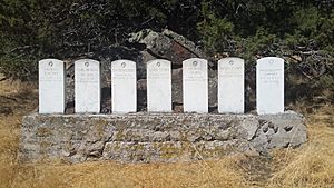
Fort Bidwell
- Location: Fort Bidwell Indian Community Center in Fort Bidwell.
- What it is: Fort Bidwell was a U.S. Army post established in 1865. It played a role in the Modoc War and other conflicts, and also served as a supply point for settlers. Today, it's part of the Fort Bidwell Indian Community.
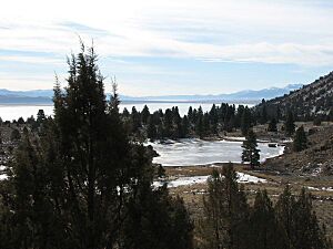
Fremont's Camp at Tule Lake
- Location: Old Alturas Highway, north of State Highway 139.
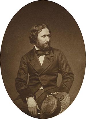
- What it is: This is where explorer John C. Frémont and his expedition camped in 1846. Frémont was mapping the American West, and his travels helped open up new routes for pioneers.
Infernal Caverns Battleground
- Location: Ferry Ranch near Likely.
- What it is: This site was the location of a significant battle during the Modoc War in 1873. The Modoc warriors used the natural caves and rocky terrain to their advantage against the U.S. Army.
Old Emigrant Trail
- Location: Northwest of County Road 84 near Canby.
- What it is: This landmark marks a section of the historic Applegate Trail, an important route for pioneers traveling from the eastern United States to Oregon and California in the mid-1800s. It was a long and difficult journey.
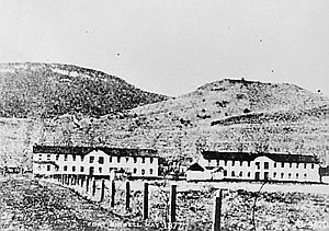
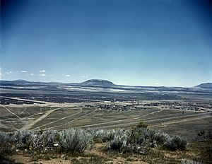
Tule Lake War Relocation Center
- Location: State Highway 139 and County Road 176 near Newell.
- What it is: This site was one of ten camps where Japanese Americans were forced to live during World War II. It was a difficult time in American history, and this center serves as a reminder of the importance of protecting civil rights.
These landmarks in Modoc County offer a glimpse into the past, helping us understand the diverse stories and events that shaped this unique part of California.
 | Toni Morrison |
 | Barack Obama |
 | Martin Luther King Jr. |
 | Ralph Bunche |


