Calloway Canal facts for kids
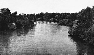
The Calloway Canal is an important irrigation canal in Kern County, California. It's owned by the North Kern Water Storage District. This canal helps bring water to farms and communities.
The Calloway Canal starts from the Kern River in Bakersfield. It's located just east of the Golden State Highway (SR 204 freeway). The canal ends at some reservoirs near McFarland, south of Whisler Road and east of SR 99 (Golden State Freeway).
Contents
How Does the Calloway Canal Flow?
The canal's path is quite interesting! From where it starts, the Calloway Canal first flows west. It goes around some industrial areas before turning southwest.
Crossing Highways and Other Canals
After crossing Rosedale Highway (SR 58), the canal makes a big turn, about 120 degrees, and then flows northwest. It crosses Rosedale Highway again. Then, it crosses another major waterway called the Friant-Kern Canal.
Running Parallel to Friant-Kern Canal
The Calloway Canal and the Friant-Kern Canal run side-by-side for a while, both heading northwest. Even though they are only about 100 feet (30 m) apart, their water flows in opposite directions! The Calloway Canal flows northwest, while the Friant-Kern Canal flows southeast. When they reach Snow Road, the distance between the two canals gets bigger, but they still run generally parallel. The Calloway Canal eventually reaches its end at the reservoirs near McFarland.
Why Was the Calloway Canal Important?
The building of the Calloway Canal caused a big disagreement over water rights. This disagreement was between two important groups: Henry Miller and Charles Lux on one side, and James Haggin and Lloyd Tevis on the other.
The Haggin-Miller Water Agreement
This disagreement, sometimes called a "water war," was very important for how water was shared in the area. It led to a special agreement in 1888 called the Haggin-Miller Water Agreement. This agreement made sure that Henry Miller and Charles Lux would always get a certain amount of water from the Kern River. This helped to settle the dispute and set rules for water use.


