Camajuaní facts for kids
Quick facts for kids
Camajuaní
|
||
|---|---|---|
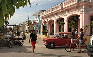
Eclectic architecture in a Camajuani street
|
||
|
||
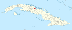
Camajuaní municipality (red) within
Villa Clara Province (yellow) and Cuba |
||
| Country | Cuba | |
| Province | Villa Clara | |
| Settled (Corral) | 1703 | |
| Became a Homestead | 1735 | |
| Founded | 1864 | |
| Incorporated | 1876 (town) 1879 (municipality) |
|
| Government | ||
| • Type | Asamblea Municipal del Poder Popular (AMPP) | |
| Area | ||
| • Municipality | 585.71 km2 (226.14 sq mi) | |
| Elevation | 115 m (377 ft) | |
| Population
(2021)
|
||
| • Municipality | 57,600 | |
| • Density | 103.5/km2 (268/sq mi) | |
| • Urban | 37,866 | |
| • Rural | 19,734 | |
| Time zone | UTC-5 (EST) | |
| Area code(s) | +53-422 | |
| Website | https://www.soycamajuani.gob.cu/es/ | |
Camajuaní is a town and a special area called a municipality in the Villa Clara Province of Cuba. It's a place with a rich history and a lively culture.
Contents
History of Camajuaní
Camajuaní started because of a new port built near Caibarién in 1819. People began to settle around this new port. In 1841, the city of Caibarién was officially founded.
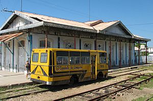
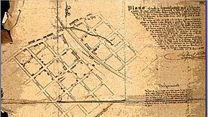
Later, in 1864, a railway line was planned. This railway would carry sugar from the Camajuaní valley to Caibarién. A new settlement began to grow near this train station. This was the start of Camajuaní village.
Becoming a Town and Municipality
On January 1, 1871, Camajuaní was declared a "villa," which means it became an official town. On August 1, 1879, the town hall was set up. The first mayor of Camajuaní was Hipólito Escobar Martelo.
In 1907, an area called Zulueta was moved from Camajuaní to the municipality of Remedios. In 1909, Camajuaní was divided into several smaller areas called barrios. These included Egido (the main city), Santa Fe, Sabana, Santa Clarita (with Falcón), Guadalupe, and Salamanca (with José María Pérez).
Geography and Landscape
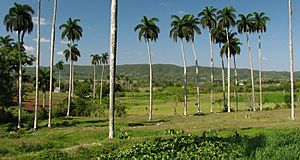
Camajuaní is located in a valley, surrounded by old mountains. Most of the city is on flat land. The Camajuaní River flows near the city. The Sagua la Chica River also passes through the area. Both rivers help make the land very fertile for farming.
Local Divisions
The municipality is divided into 9 "popular councils". These are like local districts. The main town of Camajuaní is split into two councils: Camajuaní I and Camajuaní II. Other villages that are part of the municipality include Aguada de Moya, José María Pérez, Luis Arcos Bergnes (also known as Carmita), San Antonio de las Vueltas (or Vueltas), Taguayabón, Vega Alta, and Batalla de Santa Clara.
Population Facts
In 2004, the municipality of Camajuaní had a population of 63,544 people. The total area of the municipality is about 614 square kilometers (237 square miles). This means there were about 103.5 people living in each square kilometer.
Economy and Agriculture
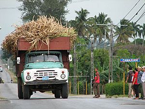
The main economic activity in Camajuaní is farming. Sugarcane and high-quality tobacco are very important crops grown here.
The Role of Railways
The town grew because of the train station built in 1864 by the "United Railways of Caibarién." This railway connected the valley to the port in Caibarién in the north. It also linked Camajuaní to Santa Clara in the south, and Vega Alta and Placetas to the west and east.
The valley quickly became important for farming tobacco and sugar. Many large sugar mills were in the Camajuaní region. Their products were sent across Cuba and to other countries using the port in Caibarién.
Farming Cooperatives
Camajuaní has many farming cooperatives. These are groups of farmers who work together. There are 17 UBPC, 33 CCS, and 15 CPA cooperatives. Some important ones include CPA Benito Ramirez in Vega Alta, UBPC Crescencio Valdés in Batalla de Santa Clara, and CCS Julio Antonio Mella in Guajén.
Culture and Traditions
Camajuaní is famous for its "parrandas". These are big carnival-like parties. Other nearby towns like Remedios, Vueltas, Taguayabón, and Caibarién also have parrandas. These celebrations have been happening since the 18th century.
Parrandas: A Friendly Competition
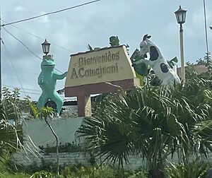
Each town's parranda is a bit different, but they share some things. For example, the people in the town divide into two neighborhoods. These neighborhoods compete each year. They try to have the best decorated floats, plaza decorations, or "Wall of lights." A "Wall of lights" is a structure that holds many lights or fireworks. They also compete in traditional dances and fireworks displays. In Camajuaní, the two competing groups are called the Chivos (Goats) and the Sapos (Toads).
Transportation Routes
Camajuaní has two main highways. They meet at a place called Entronque de Vueltas. The Circuito Norte highway comes from Encrucijada and goes towards Remedios. The Carretera de Camajuaní highway comes from Santa Clara. It joins the Circuito Norte to also go towards Remedios.
Smaller roads in the municipality usually lead to sugar mills or larger towns. These include the Carretera a Luis Arcos Bergnes, Vial a La Quinta, Carretera al Fe, and the Vial al Playa Juan Francisco. The other paved roads are for local streets.
Notable People from Camajuaní
- Juan Bruno Zayas, lived in La Quinta and Vega Alta
- Leoncio Vidal, lived in Camilo Cienfuegos St, Camajuaní I
- María Matilde Alea Fernández, born in Camajuaní
- Amaury Gutiérrez, born in Vueltas
- Alberto Herrera Franchi, born in Vueltas
- José Ramón Machado Ventura, born in Vueltas
- Carlos Mendieta, born in Vueltas
- Raúl Planas, born in Camajuaní
- Isabel Toledo, born in Camajuaní
See also
 In Spanish: Camajuaní para niños
 | Ernest Everett Just |
 | Mary Jackson |
 | Emmett Chappelle |
 | Marie Maynard Daly |


