Camas Creek (Big Wood River tributary) facts for kids
Quick facts for kids Camas Creek |
|
|---|---|

|
|
|
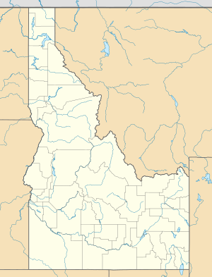
Location of the mouth of Camas Creek in Idaho
|
|
| Country | United States |
| State | Idaho |
| Counties | Camas County, Idaho, Elmore County, Idaho, Blaine County, Idaho |
| Physical characteristics | |
| Main source | west of Hill City, Elmore County, Idaho 5,807 ft (1,770 m) 43°15′28″N 115°20′57″W / 43.25778°N 115.34917°W |
| River mouth | Big Wood River Magic Reservoir, Camas/Blaine counties, Idaho 4,800 ft (1,500 m) 43°19′36″N 114°24′06″W / 43.32667°N 114.40167°W |
| Length | 64 mi (103 km) |
| Basin features | |
| Basin size | 698 sq mi (1,810 km2) |
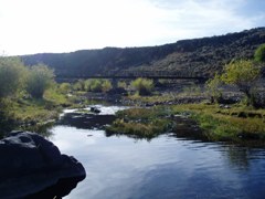
Camas Creek is a river in southern Idaho, United States. It is about 64 miles (103 km) long. This creek is a smaller stream that flows into a larger river called the Big Wood River.
About Camas Creek
Camas Creek starts its journey high up in the mountains. Its source is west of a town called Hill City. This area is in the eastern part of Elmore County. The creek begins at an elevation of about 5,807 feet (1,770 meters) above sea level.
From its source, Camas Creek flows towards the east. It soon enters Camas County. A major road, U.S. Route 20, runs alongside the creek for much of its path.
As the creek continues its journey, it reaches a point about 10 miles (16 km) east of Fairfield. Here, Camas Creek forms the border between Camas County and Blaine County. It keeps flowing east until it reaches its end.
Camas Creek empties into a place called Magic Reservoir. This is where the creek joins the Big Wood River. The mouth of the creek is at an elevation of about 4,800 feet (1,463 meters).
The land area that drains water into Camas Creek is known as its watershed. This watershed is quite large, covering about 698 square miles (1,808 square kilometers).
 | Janet Taylor Pickett |
 | Synthia Saint James |
 | Howardena Pindell |
 | Faith Ringgold |


