
Cambria, Michigan facts for kids
Quick facts for kids
Cambria, Michigan
|
|
|---|---|
.jpg)
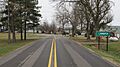
Looking south along Cambria Road
|
|

Cambria, Michigan
Location in Michigan

Cambria, Michigan
Location in the United States
|
|
| Country | United States |
| State | Michigan |
| County | Hillsdale |
| Township | Cambria |
| Settled | 1835 |
| Platted | 1878 |
| Area | |
| • Total | 1.26 sq mi (3.26 km2) |
| • Land | 1.24 sq mi (3.21 km2) |
| • Water | 0.03 sq mi (0.08 km2) |
| Elevation | 1,070 ft (330 m) |
| Population
(2020)
|
|
| • Total | 258 |
| • Density | 208.74/sq mi (80.57/km2) |
| Time zone | UTC-5 (Eastern (EST)) |
| • Summer (DST) | UTC-4 (EDT) |
| ZIP code(s) |
49242 (Hillsdale)
|
| Area code(s) | 517 |
| FIPS code | 26-12680 |
| GNIS feature ID | 622501 |
Cambria is a small community located in Hillsdale County in the United States. It is known as an "unincorporated community." This means it doesn't have its own local government, like a city or a village. For official counting, it is also called a "census-designated place" (CDP). In 2020, about 258 people lived there. Cambria is part of a larger area called Cambria Township.
Contents
History of Cambria
When Was Cambria Settled?
The area where Cambria is now was first settled around 1835. Two people named John and Andrew McDermid were among the first settlers. They built a sawmill, which was important for cutting wood. More settlers arrived by 1837.
How Cambria Got Its Name
A post office opened in the community on December 14, 1840. It was first named Woodbridge, after Michigan's governor at the time, William Woodbridge. However, by the next year, the community and the larger township were named Cambria. This new name came from Cambria, New York, which was the hometown of many of the early settlers. The post office was also renamed Cambria on June 1, 1841. It operated until August 22, 1853.
Developing the Community
The community was officially "platted" in 1878. To "plat" an area means to draw up a map that divides the land into lots, streets, and other public areas. This helps organize how the community will grow. Another nearby post office, called Cambria Mills, opened in 1848. This post office was later renamed and moved to Cambria in 1882, but it closed completely in 1906.
Cambria as a Census-Designated Place
For the 2020 census, Cambria was listed as a new "census-designated place." This means it was included for statistical purposes only, so the government could count its population. Cambria still remains an unincorporated community, which means it does not have its own separate legal government.
Geography of Cambria
How Big is Cambria?
According to the U.S. Census Bureau, the total area of the Cambria census-designated place is about 1.26 square miles (3.26 square kilometers). Most of this area, about 1.24 square miles (3.21 square kilometers), is land. A small part, about 0.03 square miles (0.08 square kilometers), is water.
Local Schools
The community of Cambria is served by the Reading Community Schools. These schools are located to the west in the nearby town of Reading.
Population Facts
How Many People Live in Cambria?
The population of Cambria was counted during the 2020 census. At that time, 258 people lived in the community.
| Historical population | |||
|---|---|---|---|
| Census | Pop. | %± | |
| 2020 | 258 | — | |
| U.S. Decennial Census | |||
Images for kids
-
Road signage along Lilac Road

