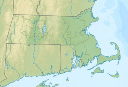
Canapitsit Channel facts for kids
Quick facts for kids Canapitsit Channel |
|
|---|---|
| Coordinates | 41°25′24″N 70°54′28″W / 41.4234412°N 70.9078122°W |
| Part of | Atlantic Ocean |
The Canapitsit Channel is a natural waterway, like a narrow river, that connects two larger bodies of water. It is located off the coast of Cape Cod, Massachusetts. This channel separates two islands: Nashawena Island and Cuttyhunk Island. These are part of a group called the Elizabeth Islands.
The Canapitsit Channel links Cuttyhunk Harbor to the Vineyard Sound. It is one of four important passages that allow boats to travel between Buzzards Bay and the Vineyard Sound. The other passages are Quick's Hole, Robinson's Hole, and Woods Hole. The name "Canapitsit" comes from an old Native American word meaning "current passage."
Strong Water Currents
The Canapitsit Channel is known for its very strong water currents. These currents can flow as fast as 6 knots. A knot is a unit of speed used for boats, equal to about 1.15 miles per hour. So, 6 knots is about 7 miles per hour!
These powerful currents are caused by the different sizes of the water bodies it connects. Vineyard Sound and Buzzards Bay fill up and empty at different rates with the tides. This difference pushes a lot of water through the narrow channel, creating the strong flow.
Boating Safety
Because of its strong currents and narrow, rocky path, the Canapitsit Channel can be dangerous for boats. Many local sailors and boaters advise against using it unless you know the area very well.
It is always important to be careful when boating in areas with strong currents or hidden rocks. Always check local advisories and maps before you go out on the water.
 | Selma Burke |
 | Pauline Powell Burns |
 | Frederick J. Brown |
 | Robert Blackburn |


