
Capá facts for kids
Quick facts for kids
Capá
|
|
|---|---|
|
Barrio
|
|

PR-111 and PR-421 in Capá
|
|

Location of Capá within the municipality of Moca shown in red
|
|

Capá
Location in Caribbean
|
|
| Commonwealth | |
| Municipality | |
| Area | |
| • Total | 2.22 sq mi (5.7 km2) |
| • Land | 2.22 sq mi (5.7 km2) |
| • Water | 0 sq mi (0 km2) |
| Elevation | 217 ft (66 m) |
| Population
(2010)
|
|
| • Total | 3,747 |
| • Density | 1,687.8/sq mi (651.7/km2) |
| Source: 2010 Census | |
| Time zone | UTC−4 (AST) |
Capá is a small community, also called a barrio, located in the municipality of Moca, Puerto Rico. In 2010, about 3,747 people lived there. It's a part of the beautiful island of Puerto Rico.
History of Capá
Capá has an interesting past, like many places in Puerto Rico. After the Spanish–American War ended in 1898, Spain gave Puerto Rico to the United States. This happened because of a special agreement called the Treaty of Paris of 1898. From then on, Puerto Rico became an "unincorporated territory" of the U.S. This means it's a part of the U.S. but doesn't have all the same rights as a state.
A year later, in 1899, the United States government counted everyone living in Puerto Rico. This was like a big survey called a census. They found that only 898 people lived in Capá barrio at that time. Over the years, more people moved to Capá, and its population grew quite a bit!
| Historical population | |||
|---|---|---|---|
| Census | Pop. | %± | |
| 1900 | 898 | — | |
| 1960 | 1,595 | — | |
| 1980 | 2,127 | — | |
| 1990 | 2,297 | 8.0% | |
| 2000 | 3,354 | 46.0% | |
| 2010 | 3,747 | 11.7% | |
| U.S. Decennial Census 1899 (shown as 1900) 1910-1930 1930-1950 1960 1980-2000 2010 |
|||
Pictures of Capá
Here are some pictures showing what Capá looks like:
-
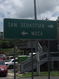
This sign on PR-421 helps people find their way to San Sebastián or Moca, near PR-111 in Capá.

More About Puerto Rico
 In Spanish: Capá (Moca) para niños
- You can learn more about other communities in Puerto Rico by checking out the List of communities in Puerto Rico.
