Cards Pond facts for kids
Quick facts for kids Cards Pond |
|
|---|---|
| Location | South Kingstown, Washington County, Rhode Island |
| Group | Salt Ponds of Rhode Island |
| Coordinates | 41°22′25″N 71°34′03″W / 41.3737128°N 71.5675593°W |
| Type | saline |
| Primary inflows | precipitation, groundwater |
| Primary outflows | to sea, breaches 8-10 times a year |
| Catchment area | 1,979.76 acres (8.0118 km2) |
| Basin countries | United States |
| Surface area | 40.95 acres (16.57 ha) |
| Average depth | 1.3 ft (0.40 m) |
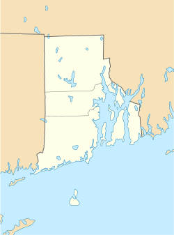
Cards Pond, also called Card Pond, is a special type of coastal lake in South Kingstown, Washington County, Rhode Island, United States. It's known as a coastal lagoon.
What is Cards Pond?
Cards Pond is one of nine coastal lagoons in southern Rhode Island. These lagoons are often called "salt ponds." A lagoon is a shallow body of water that is partly separated from the ocean.
How is Cards Pond Connected to the Sea?
Cards Pond is not always open to the sea. Its connection, called a breachway, opens only sometimes. This means the pond can be cut off from the ocean for periods. It also gets a lot of fresh water from Moonstone Stream. Only two other salt ponds in the area, Point Judith and Greenhill, have large streams flowing into them.
Animals and Nature at Cards Pond
Part of Cards Pond is inside the Trustom Pond National Wildlife Refuge. This refuge is a protected area for wildlife. It is home to more than 360 different kinds of animals. This shows how important Cards Pond is for nature.
The Land Around Cards Pond (Watershed)
A watershed is all the land where water drains into a particular lake, river, or pond. Cards Pond's watershed is quite large.
Size and Depth of the Pond
The land that drains into Cards Pond covers about 1,980 acres. Of this, about 59 acres are covered by water. Cards Pond itself has a surface area of about 41 acres. Other smaller water bodies make up the rest. The pond is quite shallow, averaging about 1.3 feet deep.
Water Salinity and Flow
The water in Cards Pond has a salinity level of about 4 parts per thousand. This means it's a mix of fresh and salt water. This level is too low for eelgrass to grow well. Eelgrass is a type of plant that grows in salty water. The pond is usually not affected by ocean tides. However, it can become tidal when storms cause it to open up to the sea. Cards Pond gets a lot of water from rain, about 51 million gallons each year. It also gets over 1.5 million gallons of water daily from underground sources.
How Cards Pond Was Formed
Cards Pond, like other ponds in the region, was formed a very long time ago. This happened after the glaciers melted about 12,000 years ago. Glaciers are huge sheets of ice that once covered much of the Earth.
Special Birds in the Area
The land around Cards Pond is home to special birds called piping plovers. These birds are considered a threatened species. This means their numbers are low, and they need protection. Nests of these birds have been found in the watershed.
Flooding Around Cards Pond
The land around Cards Pond is very low. This makes it easy for the area to flood, especially during big storms.
Storm Damage and Breaching
Even though the land is low, experts believe that future storms will cause less damage here compared to other ponds nearby. Cards Pond usually opens up to the Block Island Sound about 9 times a year. This opening is called a "breach."
Controlling Flooding
Sometimes, the pond gets too full and threatens to flood nearby roads or houses. When this happens, the U.S. Fish and Wildlife Service helps. They intentionally create a breach. This allows the extra water to flow out into the sea, which helps prevent flooding.


