
Carenero facts for kids
Quick facts for kids
Carenero
|
|
|---|---|
|
Barrio
|
|

View of Caña Gorda sector in Carenero
|
|

Location of Carenero within the municipality of Guánica shown in red
|
|

Carenero
Location in Caribbean
|
|
| Commonwealth | |
| Municipality | |
| Area | |
| • Total | 9.18 sq mi (23.8 km2) |
| • Land | 7.39 sq mi (19.1 km2) |
| • Water | 1.79 sq mi (4.6 km2) |
| Elevation | 495 ft (151 m) |
| Population
(2010)
|
|
| • Total | 2,670 |
| • Density | 361.3/sq mi (139.5/km2) |
| Source: 2010 Census | |
| Time zone | UTC−4 (AST) |
| ZIP Code |
00653
|
Carenero is a barrio (which is like a neighborhood or district) located in the town of Guánica, Puerto Rico. In 2010, about 2,670 people called Carenero home. It's known for its beautiful natural areas, including parts of the Guánica State Forest.
| Historical population | |||
|---|---|---|---|
| Census | Pop. | %± | |
| 1930 | 566 | — | |
| 1940 | 274 | −51.6% | |
| 1950 | 482 | 75.9% | |
| 1980 | 1,896 | — | |
| 1990 | 2,158 | 13.8% | |
| 2000 | 2,862 | 32.6% | |
| 2010 | 2,670 | −6.7% | |
| U.S. Decennial Census 1899 (shown as 1900) 1910-1930 1930-1950 1980-2000 2010 |
|||
Exploring Carenero's Nature
Carenero is a special place because it's home to a part of the Guánica State Forest. This forest is a dry forest, which means it gets less rain than other types of forests. It's a great spot to see unique plants and animals that are adapted to this kind of environment.
Gallery
-
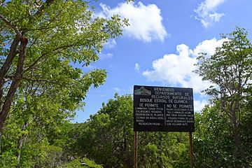
Welcome to the forest sign
-
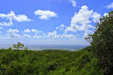
View of mountains of Carenero
-
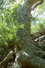
Tree in Guánica State Forest
.jpg)


See Also
 In Spanish: Carenero (Guánica) para niños
- List of communities in Puerto Rico

All content from Kiddle encyclopedia articles (including the article images and facts) can be freely used under Attribution-ShareAlike license, unless stated otherwise. Cite this article:
Carenero Facts for Kids. Kiddle Encyclopedia.