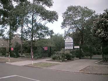
Cartwright, New South Wales facts for kids
Quick facts for kids CartwrightSydney, New South Wales |
|||||||||||||||
|---|---|---|---|---|---|---|---|---|---|---|---|---|---|---|---|

Cartwright Public School
|
|||||||||||||||
| Population | 2,370 (2016 census) | ||||||||||||||
| Established | 1972 | ||||||||||||||
| Postcode(s) | 2168 | ||||||||||||||
| Location | 38 km (24 mi) south-west of Sydney | ||||||||||||||
| LGA(s) | City of Liverpool | ||||||||||||||
| State electorate(s) | Liverpool | ||||||||||||||
| Federal Division(s) | Werriwa | ||||||||||||||
|
|||||||||||||||
Cartwright is a friendly suburb located in south-western Sydney, New South Wales, Australia. It's about 38 kilometres south-west of the main city area of Sydney. This suburb is part of the City of Liverpool, which is a local government area.
Contents
Exploring Cartwright's Location
Cartwright is surrounded by several other suburbs. These include Prestons, Miller, Ashcroft, Sadleir, Lurnea, and Liverpool. The homes here are a mix of houses, newer duplexes, and apartments.
Natural Boundaries and Parks
- Cabramatta Creek forms the northern boundary with Ashcroft and Sadleir. It also makes up the western boundary with Miller.
- Maxwells Creek creates the eastern boundary with Liverpool.
- Hoxton Park Road marks the southern edge, bordering Prestons and Lurnea.
The suburb has many shared pathways. These paths connect the different streets, especially the quiet cul-de-sacs. A bridge also connects Cartwright to Miller, crossing over Cabramatta Creek. You can find the Liverpool City BMX Club grounds in Powell Park. There is also McGirr Park in the north-east, offering more green space.
A Glimpse into Cartwright's Past
Cartwright became an official suburb in 1972. It was developed as part of the Green Valley Housing Estate during the 1960s. The suburb was named after Robert Cartwright. He was a reverend at St Luke's church in Liverpool. Reverend Cartwright received a land grant in this local area.
Learning in Cartwright
Cartwright has its own primary school. Cartwright Public School first opened its doors in 1967. For older students, the local high school is Miller Technology High School.
Getting Around Cartwright
Cartwright is well-connected by public transport. Bus services are a popular way to travel.
Bus Services
- The T80 bus service runs along a special bus-only road called the T-Way.
- Other bus routes like 802 and 803 also serve the area.
- Transit Systems operates additional bus routes, 853 and 854.
Train Connections
The closest train station is Liverpool Station. This station is on the South Line, making it easy to travel by train.
Main Roads
Hoxton Park Road is the main road in Cartwright. It connects to the Hume Highway in the east. In the west, it links up with Cowpasture Road. Cartwright Avenue also branches off to serve the smaller streets throughout the suburb.
Who Lives in Cartwright?
The 2016 census counted 2,370 people living in Cartwright. This census helps us understand the community.
Where People Are From
- About 51.1% of residents were born in Australia.
- Many people also came from other countries. The most common birthplaces were Vietnam (6.1%), Iraq (5.1%), New Zealand (2.9%), Lebanon (2.9%), and Fiji (1.7%).
Languages Spoken at Home
- English was the only language spoken at home by 44.2% of people.
- Other languages spoken included Arabic (14.0%), Vietnamese (9.5%), Samoan (4.1%), Spanish (2.3%), and Hindi (2.3%). This shows the diverse community in Cartwright.
Religious Beliefs
- The most common religious beliefs were Catholic (21.4%), Islam (14.5%), and No Religion (13.8%).
 | Emma Amos |
 | Edward Mitchell Bannister |
 | Larry D. Alexander |
 | Ernie Barnes |

