Prestons, New South Wales facts for kids
Quick facts for kids PrestonsSydney, New South Wales |
|||||||||||||||
|---|---|---|---|---|---|---|---|---|---|---|---|---|---|---|---|

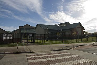
Saint Catherine of Siena Catholic Primary School
|
|||||||||||||||
| Population | 15,313 (2016 census) | ||||||||||||||
| Established | 1972 | ||||||||||||||
| Postcode(s) | 2170 | ||||||||||||||
| Location | 37 km (23 mi) south-west of Sydney CBD | ||||||||||||||
| LGA(s) | City of Liverpool | ||||||||||||||
| State electorate(s) |
|
||||||||||||||
| Federal Division(s) | Werriwa | ||||||||||||||
|
|||||||||||||||
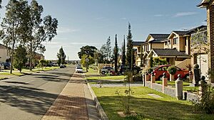
Prestons is a suburb located in Sydney, New South Wales, Australia. It's about 37 kilometres south-west of the main city area of Sydney. Prestons is part of the City of Liverpool local government area.
Contents
The Story Behind Prestons' Name
Prestons got its name from an Irish family called Preston. In the 1910s, this family ran a small post office. It was located on the corner of Romana Square. The Preston family was known for being very kind and helpful. They often gave food and other items to people in the community who needed them. Because of their generosity, their name became strongly linked with the post office. In 1972, the area officially became known as Prestons.
Schools in Prestons
Prestons is home to several schools for young people.
- Dalmeny Public School
- Prestons Public School
- William Carey Christian School (a private school)
- Saint Catherine of Siena Catholic Primary School (a private school)
- Amity College (formerly Sule College, also a private school)
Getting Around Prestons: Transport
Prestons is a very important spot for roads. It's where the M5 South Western Motorway meets the Hume Motorway and the Westlink M7. The M5 comes from the city, the Hume Motorway goes towards Canberra and Melbourne, and the M7 heads towards Mount Druitt and northern Sydney.
You can get onto all three of these major roads from Camden Valley Way. This road also connects Prestons to nearby towns like Liverpool and Camden. The M7 can also be reached from Bernera Road.
For public transport, Prestons is served by trains. You can catch trains to the city from Glenfield and Edmondson Park stations. These trains travel through Granville or via the Airport. Transit Systems also provides three different bus routes. These buses connect Prestons to Liverpool. One of the bus routes, number 850, also goes to Narellan.
Sports and Activities
Prestons has a lively sports scene for its residents.
- Prestons Cricket Club (Hornets): This club has been playing cricket since 1968. They practice and play their games at Amalfi Park.
- Prestons Robins Little Athletics: If you're interested in track and field, this group is for you! They meet every Wednesday and Friday night during the summer months. Their activities take place at the new park on Ash Road.
People of Prestons: A Diverse Community
According to the 2016 Australian census, about 15,315 people lived in Prestons. It's a very diverse suburb, meaning people from many different backgrounds live there.
- Countries of Birth: While most people (53.1%) were born in Australia, many others came from different countries. The most common countries of birth, besides Australia, were Fiji (7.4%), Philippines (3.9%), India (3.1%), Vietnam (1.8%), and New Zealand (1.8%).
- Languages Spoken: Many different languages are spoken at home in Prestons. The most common foreign languages include Hindi (9.0%), Arabic (6.5%), and Spanish (3.3%).
- Religions: The most common religion in Prestons is Catholicism (32.2%). Islam is the second most common religion (14.6%), followed by Hinduism (9.6%).
 | Kyle Baker |
 | Joseph Yoakum |
 | Laura Wheeler Waring |
 | Henry Ossawa Tanner |


