Castle Lake (Nevada) facts for kids
Quick facts for kids Castle Lake |
|
|---|---|
 |
|
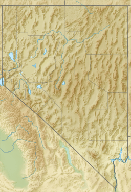
| Location | Elko County, Nevada, United States |
| Coordinates | 40°34′06″N 115°23′54″W / 40.56833°N 115.39833°W |
| Type | tarn |
| Basin countries | United States |
| Surface area | 14 acres (5.7 ha) |
| Max. depth | 15 ft (4.6 m) |
| Surface elevation | 9,793 ft (2,985 m) |
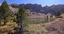
Castle Lake is a beautiful mountain lake found in the Ruby Mountains of Nevada, in the United States. It's a special type of lake called a tarn, which means it was formed by glaciers long ago.
This peaceful lake is located in Elko County. It's part of a protected area called the Ruby Mountains Wilderness. This wilderness is managed by the Ruby Mountains Ranger District of the Humboldt-Toiyabe National Forest.
Contents
What is a Tarn?
A tarn is a lake that forms in a hollow or basin carved out by a glacier. Imagine a giant ice river slowly moving down a mountain. As it moves, it scrapes away rock and soil, creating a bowl-shaped depression. When the glacier melts, this bowl fills with water, forming a tarn. Castle Lake is a perfect example of this natural process.
Where is Castle Lake Located?
Castle Lake sits high up in the mountains, on a flat area called a shelf. It's near the top of Kleckner Canyon. The lake is quite high, at an elevation of about 9,793 feet (which is about 2,985 meters) above sea level. This high elevation means it's surrounded by stunning mountain views.
How Big is Castle Lake?
Castle Lake isn't huge, but it's a significant body of water in its mountain setting. It covers an area of about 14 acres (which is roughly 5.7 hectares). At its deepest point, the lake is about 15 feet (or 4.6 meters) deep.
The Journey of Castle Lake's Water
Castle Lake plays an important role in the local water system. It is one of the starting points for Kleckner Creek. This creek flows out of the mountains and eventually joins other streams. All these streams combine to form the South Fork of the Humboldt River. So, the water from Castle Lake travels a long way!
See also
 In Spanish: Lago Castle para niños
 | Selma Burke |
 | Pauline Powell Burns |
 | Frederick J. Brown |
 | Robert Blackburn |


