Castle of Almourol facts for kids
Quick facts for kids Castle of Almourol |
|
|---|---|
|
Castelo de Almourol
|
|
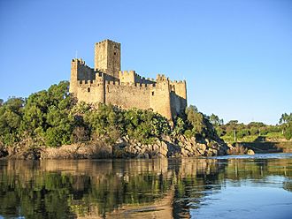
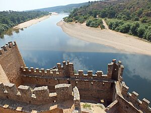
An image of the castle from the narrow channel that separates the islet of Almourol on the Tagus River
|
|
| General information | |
| Type | Castle |
| Location | Lisbon, Médio Tejo, Centre |
| Coordinates | 39°27′43″N 8°23′1.79″W / 39.46194°N 8.3838306°W |
| Completed | fl. 1171 |
| Owner | Portuguese Republic |
| Technical details | |
| Material | Granite masonry |
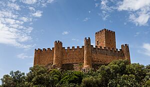
The Castle of Almourol is a cool medieval castle that sits on a small island called Almourol Islet. This island is right in the middle of the Tagus River in Portugal. It's about 4 kilometers (2.5 miles) from a town called Vila Nova da Barquinha.
This castle was super important for defense. It was part of a strong line of castles controlled by the Knights Templar. These knights used it as a fortress during the Reconquista, a time when Christian kingdoms were taking back land in the Iberian Peninsula.
Contents
The Story of Almourol Castle
People think this castle was built on an even older site. It might have been a fortified village built by the Lusitanians. Later, the Romans took it over around the 1st century BCE.
Over time, different groups like the Alans, Visigoths, and Andalusian Berbers changed it. We don't know exactly when the first castle was built here. But when people dug around the castle, they found Roman coins and other old items. They also found medieval things like medallions and marble columns nearby.
A Templar Stronghold
The Castle of Almourol is a famous example of a medieval military building from the Reconquista. It shows how much the Knights Templar influenced Portugal. In 1129, forces loyal to the Portuguese nobility captured it. Back then, it was called Almorolan.
The castle was then given to Gualdim Pais. He was the master of the Knights Templar in Portugal. He started rebuilding the castle in 1171. You can even see an inscription about this above the main gate. The castle was fixed up many times after that.
From Ruins to Official Residence
After a while, the castle lost its important military role. It was abandoned and became a ruin. But in the 1800s, people who loved romantic ideas "rediscovered" it. They imagined it as a grand, old place.
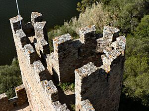
This led to big restoration projects in the 1940s and 1950s. The castle was even used as an Official Residence for the Portuguese Republic. During these repairs, many parts of the castle were changed. Things like crenellations (the notched tops of walls) and bartizans (small turrets) were added.
The government department in charge of buildings, the DGMEN, started working on it in 1939. They built walkways and fixed the main tower. They also repaired the walls and paved the ground with small stones.
Between 1940 and 1950, the castle was made ready to be an official residence. Furniture was bought for it, and an electrical system was put in. More repairs happened in the late 1950s. They made the main tower stronger and fixed the inner walls. They also improved the roads leading to the castle.
By 1996, the castle walls were repaired again. Parts of the main tower were saved, and the pavement inside the castle was restored.
Visiting Almourol Castle Today
Around 2004, the castle started showing some signs of wear because of water getting in. Some of the outer walls were affected.
Today, you can visit this Portuguese National Monument for free. However, since it's on an island, you need to pay for a boat ride to get there. It's the only way to reach this amazing castle!
What Almourol Castle Looks Like
The castle stands on a granite rock that is about 18 meters (59 feet) high. It's about 310 meters (1,017 feet) long and 75 meters (246 feet) wide. It sits right in the middle of the Tagus River, close to where the Zêzere River joins it.
The castle has an unusual rectangular shape. It has two main parts:
- An outer, lower area that faces upstream. This part has a "traitors' gate" and strong walls with nine tall, round towers.
- An inner area that is higher up. Its walls can be reached through the main gate, which leads to the main keep.
The keep is the tallest tower, with three stories. It still has the original supports for its main roof. The other guard towers are different shapes because the ground is uneven. The keep itself was a new feature for castles in this area. It appeared in the 12th century, after the Castle of Tomar, which was the main Templar fortress in Portugal. The watchtowers were also new ideas brought by the Knights Templar to western Iberia.
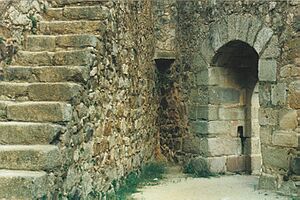
Inside the castle, several stone doorways connect different sections. Two special stones tell us about the castle's past. One above the main gate talks about its rebuilding by Gualdim Pais. Another, with a cross carved into it, shows its Christian history.
Images for kids
-
An image of the castle from the narrow channel that separates the islet of Almourol on the Tagus River
See also
 In Spanish: Castillo de Almourol para niños
 | Aaron Henry |
 | T. R. M. Howard |
 | Jesse Jackson |


