Castleton Corners, Staten Island facts for kids
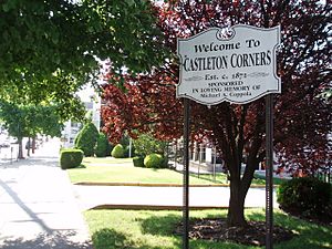
Castleton Corners is a nice neighborhood located in Staten Island, which is one of the five main parts of New York City. It's bordered by Westerleigh to the west, West Brighton to the east, Port Richmond to the north, and Todt Hill/Emerson Hill to the south. This area is often called the North Shore, Staten Island of Staten Island.
What is Castleton Corners?
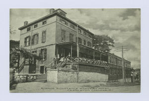
The "corners" in the name refers to a busy intersection where Victory Boulevard and Manor Road meet. This spot is like the heart of the neighborhood. A long time ago, this part of Castleton, Staten Island was known as Centerville. But it became more famous as Castleton Corners when a post office opened there in 1872.
The name "Castleton" comes from Cassiltowne, a place in Ireland. This was the birthplace of Thomas Dongan, who was an important governor of New York when it was still a colony. This happened after the Dutch, who called the area New Amsterdam, gave it to the English in 1682. The post office closed for a while but reopened in 1949. Today, it's the main post office for all of Staten Island, and its ZIP Code is 10314.
Castleton Corners is separated from its neighbor, Sunnyside, by Castleton Hill. On this hill, you can see two churches facing each other: a Moravian church and a Roman Catholic church (St. Teresa's). To the north is West Brighton, where you'll find the Staten Island Armory, a building used by the New York Army National Guard.
To the northwest and southwest are the neighborhoods of Westerleigh and Meiers Corners. Todt Hill is to the south. Even though it's called the Todt Hill public housing project, it's actually located within Castleton Corners.
The intersection of Victory Boulevard and Manor Road has always been an important shopping area. However, it became a bit less busy after the Staten Island Mall opened in 1973. Most of the buildings in Castleton Corners were already built by the time the Verrazzano-Narrows Bridge opened in 1964. Because of this, Castleton Corners didn't see as big a jump in population as many other neighborhoods on Staten Island after the bridge opened.
Schools in Castleton Corners
The main schools in this area are P.S. 29 and St. Teresa's School.
Getting Around
Castleton Corners is served by several local bus routes, including the S54, S61, S62, S66, S91, S92, S93 buses. There are also express bus routes like the SIM3, SIM31, SIM32, SIM33, SIM34 that connect to other parts of the city. Some bus routes were changed or shortened in 2010 because not enough people were using them.
 | Jewel Prestage |
 | Ella Baker |
 | Fannie Lou Hamer |


