Castleton, Staten Island facts for kids
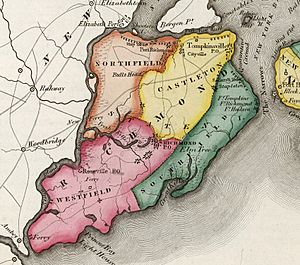
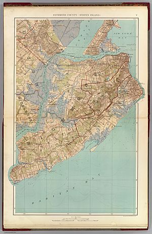
Castleton was once a town in the state of New York, located on Staten Island. Before Staten Island became part of New York City in 1898, Castleton was an important area. It covered about 3,880 acres (or 15.7 square kilometers). The town was bordered by the Upper New York Bay to the east and the Kill Van Kull waterway to the north.
Contents
What Was Castleton?
Castleton was a town that existed on Staten Island for many years. It was one of the first towns established there. Today, it is no longer a separate town. Instead, the area that was once Castleton is now part of New York City.
How Did Castleton Begin?
The history of Castleton goes back to the late 1600s. It was first set aside as a special area for the governor of the Province of New York. This was during a time when New York was still a colony ruled by England. The town got its name from Governor Thomas Dongan. He named it after his home, Castletown, which was in Ireland. His home was in a town called Kildrought, now known as Celbridge, in County Kildare.
The original manor house, which was like a large estate home, was built along Richmond Terrace. This house was located between Dongan Street and Bodine Street. Sadly, this historic building was destroyed by a fire on December 25, 1878. The state of New York officially made Castleton a town in 1788.
When Did Castleton Become Part of New York City?
Castleton stopped being a separate town in 1898. This happened when many areas around New York City joined together. This big event is called the consolidation. After this, Staten Island, including the area of Castleton, became a borough of New York City.
What Areas Are Now Part of Former Castleton?
The land that was once the town of Castleton now includes several well-known neighborhoods. If you visit Staten Island today, these areas were all part of the old Castleton:
These neighborhoods continue to be important parts of Staten Island's history and community.
 | Lonnie Johnson |
 | Granville Woods |
 | Lewis Howard Latimer |
 | James West |


