Cathedral Mountain (Tasmania) facts for kids
Quick facts for kids Cathedral |
|
|---|---|

Cathedral Mountain
|
|
| Highest point | |
| Elevation | 1,387 m (4,551 ft) |
| Geography | |
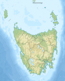
| Location | Central Highlands, Tasmania, Australia |
| Parent range | Cathedral |
| Topo map | Cathedral TasMap #4236 |
Cathedral Mountain is a very important mountain in Tasmania, Australia. It stands tall in the Cradle Mountain-Lake St Clair National Park. This park is found in the central highlands of the state.
Contents
About Cathedral Mountain
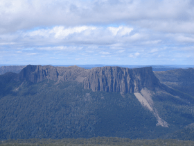
Cathedral Mountain reaches a height of 1,387 meters (about 4,550 feet). Its western side has an amazing cliff face. This cliff drops about 700 meters (2,300 feet) down to the Mersey Valley floor.
The mountain is near other famous peaks. To its west is Mount Ossa, which is Tasmania's highest mountain. To the north is Mount Pillinger. To the east, you'll find Mount Ragoona, and to the south is Castle Crag. The Mersey River flows right below Cathedral Mountain's cliffs.
Church-Themed Names
Many places around Cathedral Mountain have names linked to churches. For example, you can find Chalice Lake, Chapter Lake, and Cloister Lagoon. There are also peaks like Bishop Peak, Curate Bluff, Vicar Bluff, and Dean Bluff.
The Big Rock Slide
In recent years, a huge part of the mountain's top broke off. It crashed down through the rainforest below. This created a massive pile of rocks called a "skree." This rock pile covers hundreds of meters and almost reaches the Mersey River. You can see this big scar on the mountain from far away.
Exploring Cathedral Mountain
The famous Overland Track passes within 2 kilometers (1.2 miles) of Cathedral Mountain. This track lets you see the mountain's rugged western side from across the Mersey River.
How to Reach the Mountain
There are different ways to get close to Cathedral Mountain.
- The Overland Track is popular, especially from November to April. During this time, you need to book your walk.
- You can also use other paths like the Arm River and Innes Tracks. The Lees Paddocks track is another option. These tracks connect to the Overland Track.
Climbing to the Top
If you want to climb Cathedral Mountain, the most common way starts from the southern end of Mersey Forrest Road. You follow the Moses Creek track. This path leads you past beautiful spots like Chapter Lake, Grail Falls, Chalice Lake, and Tent Tarn. From Tent Tarn, it's about 2 kilometers (1.2 miles) to the summit. There isn't always a clear path, but you might see small piles of stones called "cairns" that help guide the way.
 | Georgia Louise Harris Brown |
 | Julian Abele |
 | Norma Merrick Sklarek |
 | William Sidney Pittman |


