Cauldstane Slap facts for kids
Quick facts for kids Cauldstane Slap |
|
|---|---|

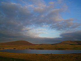
Cauldstane Slap across Harperrig Reservoir
|
|
| Elevation | 441 m (1,447 ft) |
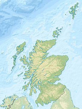
| Location | West Lothian and Scottish Borders, Scotland |
| Range | Pentland Hills |
| Coordinates | 55°48′58″N 3°24′38″W / 55.81611°N 3.41056°W |
Cauldstane Slap is a special mountain pass in the Pentland Hills of Scotland. A pass is like a natural pathway through mountains. It sits right on the border between two areas: West Lothian and the Scottish Borders. Long ago, it was also a border between older regions called Edinburghshire and Peeblesshire.
Contents
What is Cauldstane Slap?
Cauldstane Slap is a low point or "saddle" between two hills. It connects different valleys and makes it easier to travel through the mountains. This pass is 441 meters (about 1,447 feet) high.
Where is Cauldstane Slap Located?
This pass is found in the Pentland Hills, which are a range of hills in central Scotland. It's about six kilometers (almost four miles) southeast of Livingston. The pass is nestled between two hills called West Cairn Hill and East Cairn Hill.
Waterways and Reservoirs Nearby
Close to Cauldstane Slap, you'll find some important water bodies. The Water of Leith is a river that has been dammed to create the Harperrig Reservoir. This reservoir is on the western side of the Pentland Hills.
A path starts from Harperrig Reservoir and leads straight to Cauldstane Slap. This path then continues south. It eventually reaches another reservoir called Baddinsgill Reservoir. This second reservoir is located between Byrehope Mount and Mount Maw.
The Full Journey Through the Pass
The path from Cauldstane Slap follows the Lyne Water as it flows out of the reservoir. The journey through the entire pass ends near West Linton. This final point is between Faw Mount and King Seat. The whole route through the Pentland Hills using this pass is about eight kilometers (five miles) long.
 | William Lucy |
 | Charles Hayes |
 | Cleveland Robinson |


