Ceann Iar facts for kids
Disambiguation: "Ceann Iar" is a common Scottish placename meaning Western Headland
| Gaelic name | Ceann Iar |
|---|---|
| Meaning of name | Western Headland |
| OS grid reference | NF616623 |
| Coordinates | 57°31′N 7°39′W / 57.52°N 7.65°W |
| Physical geography | |
| Island group | Monach Islands |
| Area | 154 ha |
| Area rank | 122 |
| Highest elevation | Cnoc Bharr 19 m |
| Administration | |
| Sovereign state | United Kingdom |
| Country | Scotland |
| Council area | Comhairle nan Eilean Siar |
| Demographics | |
| Population | 0 |
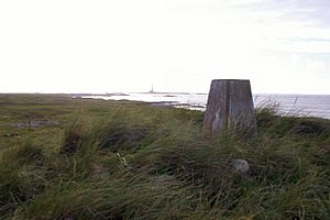
Ceann Iar is a small island in Scotland. Its name comes from the Gaelic words for "Western Headland". It is one of the Monach Islands, also known as Heisgeir. These islands are located west of North Uist in the Outer Hebrides. Ceann Iar is a long, narrow island, about two kilometers (one mile) in length.
Contents
What is Ceann Iar Like?
Ceann Iar is the second biggest island in the Monach Islands group. At low tide, you can walk from Ceann Iar to another island called Ceann Ear. They are connected by a sandy area called Sibhinis. Long ago, people say you could even walk all the way to North Uist. This was about five miles away. But in the 1500s, a huge tidal wave washed away this natural path.
Even though its name means "Western Headland," Shillay is actually the most western island of the group.
How Has the Island Changed Over Time?
Like the other Monach Islands, Ceann Iar is very flat and sandy. It is always changing because of coastal erosion. This means the sea and wind slowly wear away the land. It's possible that Ceann Iar, Sibhinis, and Ceann Ear were once one big island. Over time, they may have separated. This could be due to too many animals eating the plants (overgrazing). Wind erosion also plays a part in shaping the land.
Where Are the Main Features on Ceann Iar?
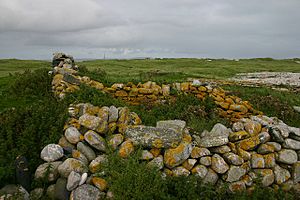
On the east side of the island is a small settlement called Baile Beag. This means "little town." It sits on the slopes of Cnoc Bhàrr, which means "top hill." This hill is 19 meters high. It is just one meter taller than the hills on nearby Ceann Ear.
In the north, you'll find Cnoc Mòr, which means "big hill." This is the other main high point on the island. The western part of Ceann Iar is a headland called Rubha Shulabhaig. To the northeast is an area known as Hearnish. Just north of Ceann Iar is the island of S(t)ròmaigh. Its name comes from an old Norse word meaning "storm island."
What is the History of Ceann Iar?
There is a pile of stones, called a cairn, on Ceann Iar. It marks the grave of Lieutenant MacNeill. He was a sailor on a ship called the HMA Laurentic. This ship hit a mine in 1917 during World War I. The accident happened near Northern Ireland. Lieutenant MacNeill's body drifted all the way to Ceann Iar.
This event fits with an old tradition from the Hebrides. It says that the sea carries drowned people home. The Monach Islands are part of the area where the Clan MacNeil lived.
People have lived on Ceann Iar off and on for over a thousand years. However, the main village was usually on Ceann Ear. Ceann Iar was settled again after the Highland Clearances. This was a time when many people were forced to leave their homes in the Scottish Highlands. But the island was finally left empty in 1942.
See also
 In Spanish: Ceann Iar para niños
 | Shirley Ann Jackson |
 | Garett Morgan |
 | J. Ernest Wilkins Jr. |
 | Elijah McCoy |


