Cedar Bluff, Virginia facts for kids
Quick facts for kids
Town of Cedar Bluff, Virginia
|
||
|---|---|---|
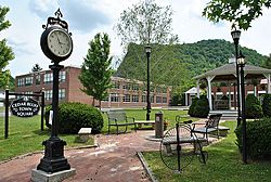
Cedar Bluff Virginia Town Square
|
||
|
||
| Motto(s):
"A Rich Historical Heritage"
|
||
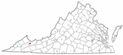
Location in the Commonwealth of Virginia
|
||
| Country | United States | |
| State | Virginia | |
| County | Tazewell | |
| Government | ||
| • Type | Town Manager Plan | |
| Area | ||
| • Total | 2.13 sq mi (5.51 km2) | |
| • Land | 2.09 sq mi (5.41 km2) | |
| • Water | 0.04 sq mi (0.10 km2) | |
| Elevation | 1,955 ft (596 m) | |
| Population
(2010)
|
||
| • Total | 1,137 | |
| • Estimate
(2019)
|
1,002 | |
| • Density | 479.43/sq mi (185.08/km2) | |
| U.S. Census Bureau, 2000 Population Estimates | ||
| Time zone | UTC−5 (EST) | |
| • Summer (DST) | UTC−4 (EDT) | |
| ZIP code |
24609
|
|
| Area code(s) | 276 | |
| FIPS code | 51-13784 | |
| GNIS feature ID | 1500063 | |
Cedar Bluff is a town located in Tazewell County, Virginia, in the United States. In 2010, about 1,139 people lived there. It is part of the larger Bluefield, WV-VA area, which has a population of over 100,000 people.
Contents
History of Cedar Bluff
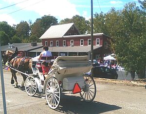
Cedar Bluff started as a mill town in the 1800s. It is located along the Clinch River in Tazewell County, Virginia. The town's historic center still looks much like it did in the 1800s. This area includes the Old Kentucky Turnpike, a street that was officially created in 1848.
The town is also home to the Clinch Valley Blanket Mill. This mill had the famous Goodwin weavers and made blankets from 1890 until World War II.
Cedar Bluff played a part in the American Civil War. You can find two markers that explain a battle that happened here. There are also graves of Civil War soldiers in the historic Jones Chapel Cemetery.
A special place in Cedar Bluff is the Cedar Bluff Overlook Park. It sits high on a bluff, giving great views of the Clinch River and the town below. Along the park's trail, you can find signs that teach you about the Clinch River's plants and animals, including some endangered species. You can also learn about the geology of the bluff itself.
Near the Clinch River, you can see the old ruins of the McGuire Mill dam. There's also a picnic area nearby where you can enjoy the outdoors.
Two important historical sites in Cedar Bluff are listed on the National Register of Historic Places. These are the Clinch Valley Roller Mills and the Old Kentucky Turnpike Historic District.
The main shopping center for the town is Claypool Hill Mall.
Geography of Cedar Bluff
Cedar Bluff is located at 37°5′17″N 81°45′53″W / 37.08806°N 81.76472°W.
The town covers a total area of about 2.3 square miles (5.9 square kilometers). All of this area is land.
Population Information
| Historical population | |||
|---|---|---|---|
| Census | Pop. | %± | |
| 1920 | 533 | — | |
| 1930 | 590 | 10.7% | |
| 1940 | 823 | 39.5% | |
| 1950 | 1,083 | 31.6% | |
| 1960 | 995 | −8.1% | |
| 1970 | 1,050 | 5.5% | |
| 1980 | 1,550 | 47.6% | |
| 1990 | 1,290 | −16.8% | |
| 2000 | 1,085 | −15.9% | |
| 2010 | 1,137 | 4.8% | |
| 2019 (est.) | 1,002 | −11.9% | |
| U.S. Decennial Census | |||
In 2000, there were 1,085 people living in Cedar Bluff. These people lived in 475 households, with 312 of them being families. On average, there were about 474 people living in each square mile of the town.
The population included people of different ages. About 22.8% were under 18 years old. About 15.5% were 65 years or older. The average age in the town was 40 years old.
Famous People from Cedar Bluff
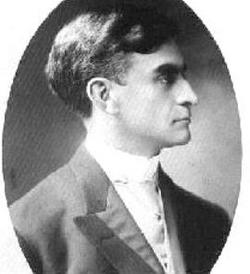
- George C. Peery was born in Cedar Bluff. He later became a Governor of Virginia.
See also
 In Spanish: Cedar Bluff (Virginia) para niños
 | Janet Taylor Pickett |
 | Synthia Saint James |
 | Howardena Pindell |
 | Faith Ringgold |


