Cedar Hills, Oregon facts for kids
Quick facts for kids
Cedar Hills, Oregon
|
|
|---|---|
|
Census-designated place (CDP)
|
|
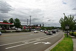
Cedar Hills Boulevard and Walker Road, looking away from the Cedar Hills CDP area
|
|
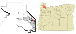
Location of Cedar Hills, Oregon
|
|
| Country | United States |
| State | Oregon |
| County | Washington |
| Established | 1946 |
| Area | |
| • Total | 1.89 sq mi (4.91 km2) |
| • Land | 1.89 sq mi (4.89 km2) |
| • Water | 0.01 sq mi (0.02 km2) |
| Elevation | 243 ft (74 m) |
| Population
(2020)
|
|
| • Total | 8,379 |
| • Density | 4,442.74/sq mi (1,715.20/km2) |
| Time zone | UTC-8 (Pacific (PST)) |
| • Summer (DST) | UTC-7 (PDT) |
| ZIP codes |
97005, 97225
|
| Area code(s) | 503 and 971 |
| FIPS code | 41-12050 |
| GNIS feature ID | 2408000 |
Cedar Hills is a community in Washington County, Oregon, United States. It is located just south of U.S. Route 26 and west of Oregon Route 217. Cedar Hills is part of the larger Portland metropolitan area. Building of the community started in 1946.
Today, the Cedar Hills neighborhood has 2,114 homes. These homes are part of a special group called the Homes Association of Cedar Hills. This group helps make sure everyone follows the rules for the area.
Contents
History of Cedar Hills
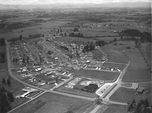
Plans for this large new neighborhood were first shared in April 1946. At that time, construction had already begun on the first 50 homes. The plan was to build about 2,000 homes across 800 acres. It also included roads, utilities, a shopping center, schools, parks, and churches.
People at the time called it "the most ambitious suburban housing development ever attempted in the Northwest." Early rules for the neighborhood had some restrictions on who could live there. These types of rules were common in many places during that time.
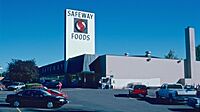
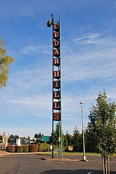
Building the Cedar Hills Shopping Center started in 1954. It opened in April 1955. The center was just south of the Sunset Highway. It first had a Safeway grocery store, a Rodgers five-and-dime store, and a Sears catalog store. There were also other shops, a bank, and a gas station. The center's tall neon sign became a well-known local landmark.
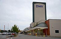
In 1979, TriMet opened a bus station behind the shopping center. This station was used for almost 20 years. It was replaced in 1998 by the Sunset Transit Center. This new center opened with the Westside MAX train line. A long pedestrian bridge was built over the highway. This bridge connects the train and bus station to the Cedar Hills neighborhood. In 2009, the Oregon Department of Transportation opened a new DMV office here.
On January 5, 2024, something unusual happened. A part of an Alaska Airlines Flight 1282 plane, called a door plug, fell off. It landed in a backyard right here in Cedar Hills!
Geography of Cedar Hills
Cedar Hills covers about 2.3 square miles (5.9 square kilometers). Most of this area is land. Only a very small part, about 0.43%, is water.
People Living in Cedar Hills
| Historical population | |||
|---|---|---|---|
| Census | Pop. | %± | |
| 2020 | 8,379 | — | |
| U.S. Decennial Census | |||
In 2020, about 8,379 people lived in Cedar Hills. Back in 2000, there were 8,949 people. There were 3,749 households, which are groups of people living together. The average household had about 2.39 people.
The community has people of all ages. About 23% of the population is under 18 years old. The median age in 2000 was 36 years. This means half the people were younger than 36, and half were older.
Public Services in Cedar Hills
Schools in Cedar Hills
Cedar Hills is part of the Beaverton School District. Two public schools are located right in Cedar Hills: Cedar Park Middle School and Barnes Elementary School. Students in the area also attend Sunset High School, Meadow Park Middle School, Ridgewood Elementary, and William Walker Elementary.
Starting with the 2017–2018 school year, students in Cedar Hills began attending Beaverton High School. This was due to changes in school boundaries.
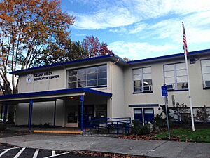
There used to be a Cedar Hills Elementary School. It was built in the early 1950s. This school closed in 1983 because fewer students were enrolling. The building is now used as the Cedar Hills Recreation Center.
Other Services in Cedar Hills
Fire and emergency medical services are provided by Tualatin Valley Fire and Rescue.
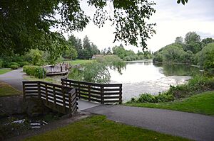
The Tualatin Hills Park & Recreation District (THPRD) serves Cedar Hills. They take care of several parks in the area. One of these is Commonwealth Lake Park, which is a man-made lake. The Oregon Department of Fish and Wildlife often puts trout into the lake. You can also find bluegill, bass, and carp there. THPRD also runs the Cedar Hills Recreation Center. This center is a place for the community to gather and do activities. It is open to everyone, not just people from Cedar Hills.
See also
 In Spanish: Cedar Hills (Oregón) para niños


