Cedar Lake (Manitoba) facts for kids
Quick facts for kids Cedar Lake |
|
|---|---|

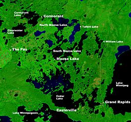
NASA image showing Cedar Lake
|
|

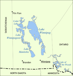
Map with the other Prairie lakes
|
|
| Location | Division No. 21, North-West Manitoba |
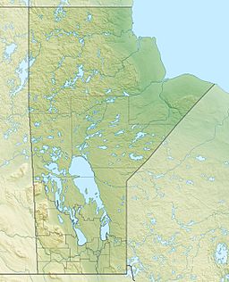
| Coordinates | 53°19′45″N 100°10′08″W / 53.32917°N 100.16889°W |
| Primary inflows | Saskatchewan River |
| Primary outflows | Saskatchewan River |
| Basin countries | Canada |
| Surface area | 1,353 km2 (522 sq mi) |
| Max. depth | 10 m (33 ft) |
| Surface elevation | 253 m (830 ft) |
Cedar Lake is a large lake located in Manitoba, Canada. It is found just north of another lake called Lake Winnipegosis. The amount of water in Cedar Lake is controlled by a special structure called the Grand Rapids dam. Two towns are close to the lake: Grand Rapids and the First Nations community of Easterville.
Amazing Amber Fossils
Cedar Lake is famous for its incredible fossil discoveries. People have found excellent examples of ancient amber here. Amber is fossilized tree resin, like hardened sap. These amber pieces are from the Cretaceous Period, which was a very long time ago. Dinosaurs were alive during this period!
The amber found near Cedar Lake has a special name: "Chemawinit". This name comes from a local First Nations tribe who live in the area. It is also sometimes called "Cedarit". This special amber often contains tiny pieces of ancient plants or insects trapped inside. Scientists call these "organic inclusions". So far, these tiny trapped pieces have not been studied in great detail.
The Saskatchewan River and the Dam
The main source of water for Cedar Lake is the Saskatchewan River. This river flows into the lake and forms a delta on the northwest side. A delta is a landform created when a river deposits sediment as it enters a larger body of water.
The flow of the Saskatchewan River out of Cedar Lake is carefully managed. On the eastern side of Cedar Lake, the river continues its journey towards Lake Winnipeg. A large structure called the Grand Rapids dam helps control this flow. The dam was built in 1962 by a company called Manitoba Hydro.
See also
- Lago Cedar (Manitoba) para niños (Cedar Lake (Manitoba) for children in Spanish)
 | Roy Wilkins |
 | John Lewis |
 | Linda Carol Brown |


