Cefn Cyfarwydd facts for kids
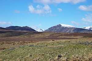
Cefn Cyfarwydd is a long, narrow mountain ridge in northern Wales. It's located in the Conwy county borough, high above the village of Trefriw. This ridge acts like a natural wall. It separates the wild, rugged mountains of the Carneddau and Llyn Cowlyd from the greener, more gentle Conwy valley.
The name Cefn Cyfarwydd comes from the Welsh language. Cefn means "ridge". Cyfarwydd can mean "familiar" or "a storyteller". So, the name could mean "familiar ridge" or "storyteller's ridge".
Contents
What is Cefn Cyfarwydd Like?
Cefn Cyfarwydd is a ridge that reaches about 500 meters (1,640 feet) high. It covers an area of about 8 square kilometers (3 square miles). This is roughly 4 kilometers (2.5 miles) long and 2 kilometers (1.2 miles) wide.
The Ridge's Shape and Landscape
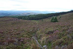
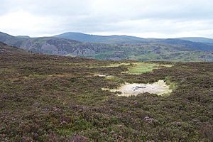
The ridge mostly runs from southwest to northeast. Its top is quite flat. Because of this, you might find some wet pools and muddy spots, even in summer. Much of the ridge is covered in heather moorland. Moorland is a type of open, uncultivated land.
To the northwest, the land slopes steeply down to Llyn Cowlyd. To the southeast, it drops towards Llyn Crafnant and the Crafnant valley. Some parts of these slopes are covered with forests. The slope facing southeast is steeper than the one facing northwest.
Where Does the Ridge End?
At its northeast end, the ridge goes down into the Conwy valley. This is between Trefriw and Dolgarrog. Towards the southwest, Cefn Cyfarwydd connects to another area called Pen y Graig Gron. This name means "top of the round stone". From there, the land rises to the Creigiau Gleision ridge, which is over 600 meters (1,968 feet) high. Its name means "blue-green rocks". For most of its length, Cefn Cyfarwydd offers amazing views in every direction.
How High is Cefn Cyfarwydd?
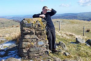
You can find a special marker called a trig point on Cefn Cyfarwydd. This marker helps mapmakers measure heights. It shows a height of 419 meters (1,375 feet). This trig point is easy to see from Ffordd Cowlyd. This is a lane that goes from Trefriw to Llyn Cowlyd. The lane crosses the northern part of Cefn Cyfarwydd.
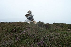
However, the trig point is not the highest spot on the ridge. The very highest point is about a mile (1.6 km) to the southwest. Here, a pile of stones called a cairn marks the top. This spot is 503 meters (1,650 feet) high. It's just north of an ancient burial cairn called Lledwigan, which is likely from the Bronze Age.
How to Explore Cefn Cyfarwydd
The top of Cefn Cyfarwydd is a wild and remote place. It's very different from the busy Conwy valley below. Even though it feels remote, you can reach it using several public footpaths.
Paths to the Ridge
Here are some ways to get to the ridge:
- From the south end of Llyn Crafnant, you can follow a path towards Capel Curig.
- Another path from the south end of Llyn Crafnant goes through the forested slopes.
- You can also start halfway down the Crafnant valley, going around Lledwigan Farm.
- Ffordd Cowlyd, the road from Trefriw, crosses the northern end of the ridge near the trig point.
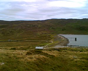
- A path goes up to the ridge top from the Llyn Cowlyd dam.
- You can also come from Capel Curig, by way of The Crimpiau or Creigiau Gleision.
Walking on the Ridge
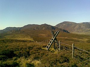
It's possible to walk the whole length of the ridge. However, the northern half doesn't have clear paths through the heather, gorse, and bilberry plants. There are also many boggy (muddy) spots. Sheep tracks crisscross everywhere. Some of these are used by farmers' quad bikes and are the best options. But they can be hard to find, even on a clear day. It's often easier to find a good path if you are walking from south to north, towards the Trefriw road. This is because you can see the paths more clearly when looking down.
Ancient History of the Ridge
Cefn Cyfarwydd has many signs of old settlements. Experts have found evidence of people living here a very long time ago.
Early Settlements
In the 1990s, a survey found about 600 new historical sites on the ridge. The oldest signs of activity are four cairns, which are piles of stones. These probably date back to the Bronze Age. There was also a round hut with other buildings nearby. This suggests people lived here in late prehistoric times.
Medieval and Farming Life
Many remains show that people lived here during the Middle Ages. These settlements were not on the exposed top of the ridge. Instead, they were usually found between 250 and 350 meters high. The soil was better there, and it offered more shelter.
Most of the later sites are connected to farming. In some places, you can still see traces of old field patterns. Today, the most noticeable remains are abandoned farmhouses. There are even two abandoned chapels. Some of these buildings might have been hafotai. These were summer homes used by farmers who moved their animals to higher pastures in warmer months.
Past Industries on Cefn Cyfarwydd
The ridge also shows signs of old industries. People used to cut peat here. Peat is a type of soil made from decayed plants, used as fuel. You can also find the remains of small mines and quarries. One example is the Cefn Cyfarwydd slate mine.
How the View Has Changed
The view from Cefn Cyfarwydd has changed a lot over time. You can see how the landscape has developed. The Cowlyd Dam was built, and large electricity pylons appeared further down the Conwy Valley. The town of Llanrwst has also grown bigger. In the 21st century, 12 large wind turbines were built at the Moel Maelogan wind farm. This wind farm is on the other side of the Conwy Valley and is very easy to see from Cefn Cyfarwydd.
 | Delilah Pierce |
 | Gordon Parks |
 | Augusta Savage |
 | Charles Ethan Porter |


