Cefn yr Ogof facts for kids
Quick facts for kids Cefn yr Ogof |
|
|---|---|

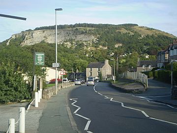
Cefn-yr-Ogof from Llanddulas
|
|
| Highest point | |
| Elevation | 204 m (669 ft) |
| Prominence | 102 m (335 ft) |
| Parent peak | Mwdwl-eithin |
| Listing | HuMP |
| Geography | |
| Location | Conwy, Wales |
| OS grid | SH916773 |
| Topo map | OS Landranger 116 |
Cefn yr Ogof is a hill in Wales, located west of Gwrych Castle near the towns of Abergele and Llanddulas. It is the highest point of its local area. The name "Cefn yr Ogof" means "ridge of the cave" in Welsh, referring to caves found on the hill.
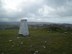
This hill stands 204 metres (669 feet) high. From the top, you can see amazing views. You might spot the Clwydian Hills, the Denbigh Moors, Snowdonia, the Great Orme, and even Anglesey. You can also see the Dulas valley below.
Who Owns the Land?
The land on Cefn yr Ogof is owned by different groups. Some parts are managed by Welsh National Resources. This is on behalf of the National Assembly of Wales. Other parts are privately owned, like the land right around Gwrych Castle. The western slopes are mostly "common land." This means that people are allowed to walk and explore there.
Special Hill Status
Cefn yr Ogof has a special status called a HuMP. This stands for "Hundred Metre Prominence." A hill gets this status if it rises at least 100 metres (about 328 feet) from the land around it. This shows it's a significant hill, not just a small bump.
Protecting Nature
A large part of Cefn yr Ogof is a SSSI. This means it's a special area protected for its wildlife or geology. These places are important for nature. They help protect rare plants, animals, or unique landforms.


