Cerro Negro de Mayasquer facts for kids
Quick facts for kids Cerro Negro de Mayasquer |
|
|---|---|
| Highest point | |
| Elevation | 4,445 m (14,583 ft) |
| Listing | Volcanoes of Colombia |
| Geography | |
| Location | Nariño Carchi |
| Parent range | Central Ranges Cordillera Real Andes |
| Geology | |
| Age of rock | Pleistocene |
| Mountain type | Andesitic stratovolcano |
| Volcanic belt | Northern Volcanic Zone, Andean Volcanic Belt |
| Last eruption | July 1936(?) |
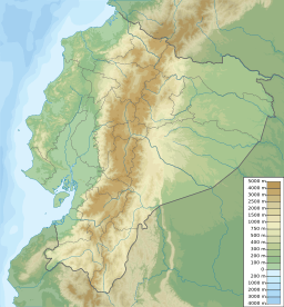
Cerro Negro de Mayasquer is a volcano located right on the border between Colombia and Ecuador. It is a tall mountain that is part of the Andes mountain range. This volcano is very close to another one called Chiles. The two peaks are considered part of the same volcanic group.
Contents
What is Cerro Negro de Mayasquer?
Cerro Negro de Mayasquer is a type of volcano known as a stratovolcano. This means it is shaped like a cone and built up by many layers of hardened lava, ash, and rocks. The rocks that make up this volcano are mostly andesitic. This is a common type of volcanic rock.
Where is this Volcano Located?
This volcano sits exactly on the border between two South American countries. On the Colombian side, it is in the Nariño Department. On the Ecuadorian side, it is in the Carchi Province. It is only about 3 kilometers (about 2 miles) northwest of the Chiles volcano.
Has Cerro Negro de Mayasquer Erupted?
Scientists believe that Cerro Negro de Mayasquer has not erupted for a very long time. It has been quiet for around 160,000 years. There was a report in July 1936 about an eruption. However, experts think this eruption might have actually come from a different Ecuadorian volcano called Reventador. This means Cerro Negro de Mayasquer has likely been dormant for a very long time.
See also
 In Spanish: Cerro Negro de Mayasquer para niños
- List of volcanoes in Colombia
- List of volcanoes in Ecuador
- List of volcanoes by elevation
 | Audre Lorde |
 | John Berry Meachum |
 | Ferdinand Lee Barnett |


