
Chiles (volcano) facts for kids
Quick facts for kids Chiles |
|
|---|---|
| Volcán Chiles | |

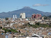
Chiles in 2010
|
|
| Highest point | |
| Elevation | 4,698 m (15,413 ft) |
| Listing | Volcanoes of Colombia Volcanoes of Ecuador |
| Geography | |

Chiles
Location in Ecuador
|
|
| Location | Nariño, Colombia Carchi, Ecuador |
| Parent range | Central Ranges Cordillera Real Andes |
| Geology | |
| Age of rock | Pleistocene |
| Mountain type | Andesitic stratovolcano |
| Volcanic belt | Northern Volcanic Zone, Andean Volcanic Belt |
| Last eruption | July 17, 1936(?) |
| Climbing | |
| Easiest route | Ecuador side - Class 3 scramble |
Chiles is a volcano located right on the border between two South American countries: Colombia and Ecuador. It's about 3 kilometers (2 miles) southeast of another volcano called Cerro Negro de Mayasquer. These two volcanoes are actually part of one big group, known as the Chiles-Cerro Negro volcanic complex.
Chiles and its neighbors, like Cumbal, are made of a type of rock called andesite. This rock is common in volcanoes. There was a report of an eruption in 1936, but it might have been from a different volcano in Ecuador called Reventador. If that's true, Chiles hasn't erupted in about 160,000 years! That's a very long time.
What is a Volcano?
A volcano is like a mountain that has a deep opening, or vent, that goes down to a pool of molten rock (magma) inside the Earth. When this magma, along with gases and ash, pushes its way up and out, it's called a volcanic eruption.
Chiles is a type of volcano called a stratovolcano. These volcanoes are usually tall and cone-shaped. They are built up over time by many layers of hardened lava, ash, and rocks from past eruptions.
Recent Shaking at Chiles
Volcanoes can be active even if they aren't erupting. Sometimes, lots of small earthquakes happen around them. This is a sign that things are moving underground.
On October 20, 2014, a fairly strong earthquake happened near the Chiles and Cerro Negro de Mayasquer volcanoes. It had a magnitude of 5.8, which means it was quite powerful. People felt this earthquake far away, in cities like Pasto, Colombia, and Quito, Ecuador.
The very next day, on October 21, 2014, scientists noticed something unusual. There was a huge "seismic swarm" near the volcanoes. A seismic swarm is when many small earthquakes happen in a short amount of time in the same area. In just 18 hours, over 4,300 earthquakes were recorded!
These earthquakes were happening about 3 to 5 kilometers (2 to 3 miles) deep, southwest of the Chiles volcano. Some of them were strong enough for people to feel. By the end of that day, over 7,700 earthquakes had been recorded. This was the most earthquakes ever recorded in one day since monitoring began in 2013. By the end of November 2014, over 132,000 earthquakes had occurred in this small area!
Scientists watch these earthquake swarms closely. They can be a sign that magma is moving underground, which might lead to an eruption.
Hot Springs Near Chiles

The Chiles-Cerro Negro volcano area has at least two places with hot springs. These are called hydrothermal areas. Hot springs are natural springs where hot water comes out of the ground. This water is heated by the Earth's inner warmth, often near volcanoes.
One of these hot springs is called Aguas Hediondas, which means "smelly waters." It's located about 3.2 kilometers (2 miles) east of the Chiles volcano summit, in Ecuador, very close to the Colombian border. The name "smelly waters" fits because it has a very strong sulfur smell. This smell comes from a gas called hydrogen sulfide dissolved in the water. Scientists measured a very high amount of hydrogen sulfide there, one of the highest ever found in a hot spring!
The water at Aguas Hediondas is also quite acidic, with a pH of 4.5. Most hot springs are not this acidic.
Another group of hot springs is called Aguas Termales de Tufiño. These are about 8 kilometers (5 miles) east of the volcano, on the Colombian side of the border. The water here is different from Aguas Hediondas. It usually has a neutral pH and almost no hydrogen sulfide. There are even commercial pools here where people can go bathing in the warm water.
The owners of these pools noticed something interesting during the big earthquake swarm in October 2014. The water in their pools changed color for several days before going back to normal. This shows how connected the hot springs are to the volcano's activity deep underground.
Gallery
-
2013
-
2015
-
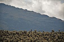
Eastern flank in 2018


See also
 In Spanish: Volcán Chiles para niños
- List of volcanoes in Colombia
- List of volcanoes in Ecuador
- List of volcanoes by elevation
