Champlain River facts for kids
Quick facts for kids Champlain River |
|
|---|---|

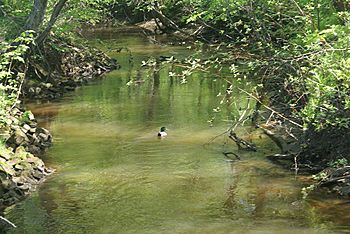
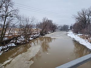
Upper part of Champlain River in Trois-Rivières (Sector Saint-Louis-de-France)
|
|
| Country | |
| Province | |
| Region | Mauricie |
| Physical characteristics | |
| Main source | Brook Saint-Maurice, Les Chenaux Regional County Municipality 59 m (194 ft) 46°26′49″N 72°16′52″W / 46.44694°N 72.28111°W |
| River mouth | St Lawrence River Champlain, Mauricie administrative region 5 m (16 ft) 46°26′49″N 72°16′55″W / 46.44694°N 72.28194°W |
| Length | 66.7 km (41.4 mi) |
| Basin features | |
| Tributaries |
|
The Champlain River is a river in the province of Quebec, Canada. It is about 66.7 kilometers (41.4 miles) long. The river flows on the north side of the mighty St. Lawrence River. It is located in the Mauricie region, between the Saint-Maurice River and the Batiscan River.
Contents
Where is the Champlain River?
The Champlain River flows mostly along the border between the areas of Batiscan and Champlain. It starts in wetlands about 130 meters (426 feet) high. These wetlands are found at the base of the Saint-Narcisse moraine (a type of landform).
The river flows from north to south. It eventually empties into the St. Lawrence River near the village of Champlain.
Which Towns Does the River Flow Through?
The Champlain River's watershed (the area of land that drains into the river) covers several towns. These include Notre-Dame-du-Mont-Carmel, Trois-Rivières (specifically the Saint-Louis-de-France area), Saint-Maurice, Saint-Narcisse, Saint-Luc-de-Vincennes, Sainte-Geneviève-de-Batiscan, Batiscan, and Champlain. Most of these towns are in the Les Chenaux Regional County Municipality.
How Does the River Flow?
The Champlain River has a main channel and four smaller branches that connect to it. The river has many bends, called meanders. Some of these meanders have been left behind as the river changed its path over time, especially near where it meets the St. Lawrence River.
The river's watershed is divided into five smaller areas, called sub-basins. The slope of the river changes along its path. For example, the "rivière Brulée" (Burned River) sub-basin has a steeper slope of 5.0 meters per kilometer. The lower part of the Champlain River has a gentler slope of 0.7 meters per kilometer.
What Are Landslides and Why Do They Happen Here?
The banks of the Champlain River are made of marine clays. This type of clay is very unstable. When a lot of water builds up in the clay soil, it can cause landslides. A landslide is when a large amount of earth or rock slides down a slope.
Past Landslides in Saint-Luc-de-Vincennes
There have been several landslides in the area of Saint-Luc-de-Vincennes:
- 1823 – A clay landslide occurred.
- 1878 – Another clay landslide happened.
- 1895 – A clay landslide occurred, and five people died.
- 1981 – More clay moved in a landslide.
- 1986 (September) – A landslide took part of a road and some empty land.
The 2016 Landslide
A significant landslide happened during the night of November 9 to 10, 2016. It took place on a piece of land in Saint-Luc-de-Vincennes. The ground started to move around 9:30 PM on November 9. This landslide was about one kilometer (0.6 miles) away from the site of the 1986 landslide. The 1986 event was twice as big as the one in 2016.
The landslide stopped about ten meters (33 feet) from a house and a barn. The barn housed about sixty cattle. This natural event created a large crater, like a baseball field. It was about 160 meters (525 feet) wide and between 2 to 10 meters (6.5 to 33 feet) deep. It formed between the farm buildings and the river's edge.
Thousands of tons of clay and earth slid into the river. This completely blocked the river's flow for many tens of meters. The water then rose until it found a new path. Two houses were evacuated, and a safety area of 200 meters (656 feet) was set up around the crater.
How Did the River Get Its Name?
The Champlain River was named after Samuel de Champlain. He was a French explorer who mapped parts of Canada. The river's name first appeared on his map in 1613. He showed it again on his map in 1632.
The name "Champlain" was later given to other places and things in the area:
- The lordship (a historical land area) in 1664.
- The Catholic parish in 1665.
- The provincial county in 1829.
- The municipality (town) in 1845.
- The Federal county in 1867.
The name "Champlain River" was officially recognized by the Commission de toponymie du Québec (Quebec's place names commission) on December 5, 1968.
What is the History of the Champlain River?
In 1863, a writer named Stanislas Drapeau Champlain wrote about the river. He noted that the Champlain River had enough water power. This power could run flour mills and sawmills. It could also power a large tannery owned by Mr. Richardson from Quebec.
Around 1800, Mathew Bell built a mill with 32 saws. This mill burned down in 1850. It was replaced by a new sawmill with 20 saws and a tannery. The tannery belonged to L. Osborne Richardson. In 1875, the tannery was moved to the Eastern Townships.
 | Bessie Coleman |
 | Spann Watson |
 | Jill E. Brown |
 | Sherman W. White |


