
Chavornay, Ain facts for kids
Quick facts for kids
Chavornay
|
|
|---|---|
|
Part of Arvière-en-Valromey
|
|

Église St André
|
|

Chavornay
Location in France

Chavornay
Location in Auvergne-Rhône-Alpes
|
|
| Country | France |
| Region | Auvergne-Rhône-Alpes |
| Department | Ain |
| Arrondissement | Belley |
| Canton | Plateau d'Hauteville |
| Commune | Arvière-en-Valromey |
| Area
1
|
7.77 km2 (3.00 sq mi) |
| Population
(2021)
|
200 |
| • Density | 26/km2 (67/sq mi) |
| Time zone | UTC+01:00 (CET) |
| • Summer (DST) | UTC+02:00 (CEST) |
| Postal code |
01510
|
| Elevation | 305–1,440 m (1,001–4,724 ft) (avg. 430 m or 1,410 ft) |
| 1 French Land Register data, which excludes lakes, ponds, glaciers > 1 km2 (0.386 sq mi or 247 acres) and river estuaries. | |
Chavornay was a small area, known as a commune, located in eastern France. It was part of the Ain department. Think of a commune as a local town or village area, and a department as a larger region, similar to a county.
On January 1, 2019, Chavornay joined with another commune to form a new, larger commune called Arvière-en-Valromey. This means Chavornay no longer exists as a separate commune on its own.
How Many People Lived in Chavornay?
The number of people living in Chavornay changed over the years. This is called its population.
| Historical population | ||
|---|---|---|
| Year | Pop. | ±% p.a. |
| 2006 | 176 | — |
| 2011 | 209 | +3.50% |
| 2015 | 220 | +1.29% |
| 2021 | 200 | −1.58% |
| Source: INSEE | ||
As you can see, the population was around 200 people in recent years. It grew a bit between 2006 and 2015 before decreasing slightly by 2021.
Images for kids
-
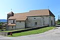
The Église St André (Saint Andrew's Church) in Chavornay.
See also
- In Spanish: Chavornay (Ain) para niños

All content from Kiddle encyclopedia articles (including the article images and facts) can be freely used under Attribution-ShareAlike license, unless stated otherwise. Cite this article:
Chavornay, Ain Facts for Kids. Kiddle Encyclopedia.