Chenango, Texas facts for kids
Quick facts for kids
Chenango, Texas
|
|
|---|---|

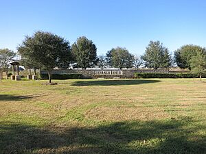
Entrance to Chenango Ranch subdivision
|
|
| Country | United States |
| State | Texas |
| County | Brazoria |
| Elevation | 39 ft (12 m) |
| Time zone | UTC-6 (Central (CST)) |
| • Summer (DST) | UTC-5 (CDT) |
| Area code(s) | 979 |
| GNIS feature ID | 1379536 |
Chenango is a small, unincorporated community. It is located in Brazoria County, Texas, in the United States. This community is part of the larger Greater Houston metropolitan area.
Contents
History of Chenango
Early Beginnings and Plantations
The community of Chenango gets its name from an older town. This town is called Chenango, New York. Chenango, Texas, started around a large farm. This farm was known as Chenango Plantation. It covered about 1,300 acres of land.
In the 1800s, more land was added to the plantation. S. Richardson and Joshua Abbott added about 3,000 acres. Around 1835, parts of this land were bought by Benjamin Fort Smith, Monroe Edwards, and Christopher Dart. They changed the main crop grown on the plantation. It went from cotton to sugarcane. The plantation used enslaved people to grow these crops.
Changes and Growth
In the 1840s, the area was known as "Parker's Point." James Love and Albert T. Burnley became partners in the plantation. Later, Captain Sharpe owned the plantation. He was an officer in the Eighth Texas Cavalry, also known as Terry's Texas Rangers.
A post office opened in Chenango in 1869. It closed in 1871 but reopened in 1877. The post office finally closed after 1930. In 1884, about 40 people lived in Chenango. It also became a station on the railroad.
Businesses and Population Changes
By 1914, the population had slightly decreased to 30 residents. However, the community had two general stores. It also had a cotton gin, which is a machine that separates cotton fibers from their seeds.
In 1929, Chenango had 100 residents. There were four businesses operating in the community. A decade later, two businesses closed. The population also dropped by half. By the next year, there were 20 registered voters. In 1947, only one business remained. After 1950, Chenango was no longer listed in the census. However, some oil production began. Chenango Plantation also started raising cattle and growing feed crops.
Where is Chenango?
Chenango is located in Brazoria County. You can find it where State Highway 521 crosses the International & Great Northern Railroad. It is about seven miles north of Angleton.
Schools in Chenango
Past Education
In 1906, Chenango had two schools. One school was for white children. It had two teachers and 20 students. The other school was for black children. It had five teachers and 180 students.
By 1947, white children from Chenango went to school in the Angleton Independent School District. Black children continued to attend school in Chenango.
Current Education
Today, the Angleton Independent School District still serves the community. Children living in the Chenango area attend schools in Angleton. These schools include:
- Rancho Isabella Elementary School
- Angleton Junior High School
- Angleton High School
Famous Person from Chenango
- Clarence Sasser: He received the Medal of Honor, a very important award for bravery.
 | James Van Der Zee |
 | Alma Thomas |
 | Ellis Wilson |
 | Margaret Taylor-Burroughs |


