Chigoubiche Lake facts for kids
Quick facts for kids Chigoubiche Lake |
|
|---|---|

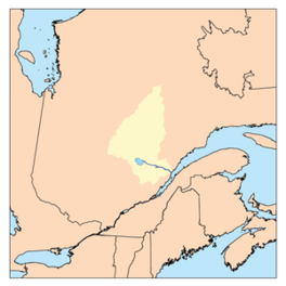
Watershed of Saguenay River
|
|
| Location | Lac-Ashuapmushuan, Quebec (unorganized territory), Le Domaine-du-Roy (RCM) |
| Coordinates | 49°05′31″N 73°31′25″W / 49.09194°N 73.52361°W |
| Type | Natural |
| Primary inflows |
|
| Primary outflows | Chigoubiche River. |
| Basin countries | Canada |
| Max. length | 7.7 kilometres (4.8 mi) |
| Max. width | 5.5 kilometres (3.4 mi) |
| Surface area | 9.67 kilometres (6.01 mi) |
| Surface elevation | 397 metres (1,302 ft) |
Chigoubiche Lake is a large freshwater lake in Quebec, Canada. It's the main source of the Chigoubiche River. This river flows into the Ashuapmushuan River. The lake is located in a wild area called Lac-Ashuapmushuan, Quebec. This area is part of the Le Domaine-du-Roy region in Saguenay-Lac-Saint-Jean.
The lake is about halfway between the towns of Saint-Félicien, Quebec and Chibougamau. It is the biggest lake in the Ashuapmushuan Wildlife Reserve. The Canadian National Railway and Route 167 run along the northeast side of the lake. There is also a forest road that goes around the lake.
The main activity in this area is forestry, which means cutting down trees. After that, tourism and outdoor activities are also very popular.
The surface of Chigoubiche Lake is usually frozen from early November until mid-May. It's generally safe to walk or play on the ice from mid-November to mid-April.
About Chigoubiche Lake
Chigoubiche Lake is about 7.7 kilometres (4.8 mi) long. It has a maximum width of 5.5 kilometres (3.4 mi). The lake sits at an altitude of 359 metres (1,178 ft) above sea level. Many smaller lakes around it feed into Chigoubiche Lake. It is located about 7.1 kilometres (4.4 mi) east of Ashuapmushuan Lake.
The water from Chigoubiche Lake flows into the Chigoubiche River. This river then flows into the Ashuapmushuan River. The Ashuapmushuan River eventually reaches Lac Saint-Jean. From there, the water flows into the Saguenay River.
Rivers and Streams Nearby
Many rivers and streams are close to Chigoubiche Lake. They help make up the lake's water system.
- To the north: Desgly Lake, Ashuapmushuan River.
- To the east: Ashuapmushuan River, Garlin Creek.
- To the south: rivière du Grand Portage, Lavin Creek.
- To the west: rivière de la Licorne, Ashuapmushuan Lake.
The Chigoubiche River starts from a bay on the southeast side of the lake. The river flows east for about 40 kilometres (25 mi). It then joins the Ashuapmushuan River. From there, the water flows southeast towards Lac Saint-Jean.
History of the Name
The name "Chigoubiche" comes from the Innu language. In 1732, a surveyor named Joseph-Laurent Normandin wrote down this name. It comes from the Innu word "ushukupish." This word means "the place where les Betsis (Saw-Bees) brood."
The name has been spelled in different ways over time. Some old spellings include "Lake Chigobiche" and "Lake Shecoubish." The Innus of Mashteuiatsh still use the form "Ushukupis Shakahikan." From about 1950 to 1964, the lake was called "Argenson Lake." This was because of the township where it is located.
In the past, local Native people used the river and Chigoubiche Lake. They found it the shortest way to reach Ashuapmushuan Lake. This lake is just a few kilometers to the west. Normandin's notes from his travels mention many animals in this area. These included beavers, caribou, foxes, and martens. Hunters and traders often visited this region for its wildlife.
Today, people still hunt in this area. Nature lovers also enjoy sport fishing. You can catch fish like pike and walleye here.
The official name "lac Chigoubiche" was set on December 5, 1968. This was done by the Commission de toponymie du Québec.
 | James Van Der Zee |
 | Alma Thomas |
 | Ellis Wilson |
 | Margaret Taylor-Burroughs |


