Ashuapmushuan River facts for kids
Quick facts for kids Ashuapmushuan River |
|
|---|---|

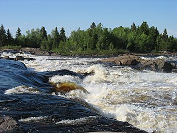
Michel Falls at Saint-Félicien
|
|
| Country | Canada |
| Province | Quebec |
| Region | Saguenay–Lac-Saint-Jean |
| Physical characteristics | |
| Main source | Lake Ashuapmushuan Lac-Ashuapmushuan Unorg. Terr. 360 m (1,180 ft) 49°13′50″N 73°45′15″W / 49.23056°N 73.75417°W |
| River mouth | Lac Saint-Jean Pointe-Saint-Méthode (Saint-Félicien) 100 m (330 ft) 48°37′03″N 72°20′00″W / 48.61750°N 72.33333°W |
| Length | 181 km (112 mi) |
| Basin features | |
| Basin size | 15,746 km2 (6,080 sq mi) |
| Tributaries |
|
The Ashuapmushuan River is a long river located in the Saguenay–Lac-Saint-Jean region of Quebec, Canada. It begins at Ashuapmushuan Lake and flows for about 181 kilometres (112 mi) (112 miles) before emptying into Lac Saint-Jean. It is the third largest river that flows into Lac Saint-Jean, after the Peribonka River and Mistassini River.
The amount of water flowing in the river changes throughout the year. In summer, it usually flows between 200 and 300 cubic metres per second (7,100 and 10,600 cu ft/s) (cubic meters per second). During the spring, when snow melts, the flow can reach 1,050 cubic metres per second (37,000 cu ft/s) (about 37,000 cubic feet per second). The lowest water levels are usually in March, with a median flow of 75 cubic metres per second (2,600 cu ft/s) (about 2,600 cubic feet per second).
The Ashuapmushuan River forms the northern edge of the Ashuapmushuan Wildlife Reserve for most of its path. Because it's a wild river, it's a popular spot for canoe camping. You can easily reach it from Quebec Route 167 near Ashuapmushuan Lake.
There are plans to create a new aquatic reserve covering 276.6-square-kilometre (106.8 sq mi) (106.8 sq mi) along 126 kilometres (78 mi) (78 miles) of the river. This reserve would help protect the river, its floodplains, and its valleys. It would prevent logging, mining, and building hydro-electric dams. This is important for protecting special places where landlocked salmon live, keeping the area's many different plants and animals safe, and preserving old archaeological sites.
Contents
What Does "Ashuapmushuan" Mean?
The name Ashuapmushuan was officially adopted in 1982. It comes from the Innu-aimun language, spoken by the Innu people. The name means "place where one lies in wait for moose."
However, this river had other names before. In 1679, Louis Jolliet called it Necouba. This name was also used on maps by Jean-Baptiste-Louis Franquelin and Guillaume Delisle in the late 1600s and early 1700s. Later, in 1732, a surveyor named Normandin thought this was a mistake. He renamed the river Chomontchouane. In 1917, the Commission de géographie (a group that names places) officially chose the modern spelling, Chamouchouane.
Where is the Ashuapmushuan River Located?
The Ashuapmushuan River flows through a region known for its many lakes and forests. For much of its journey, the river is found in narrow valleys. It has many powerful rapids and several waterfalls. The most impressive of these are the Chaudière Falls.
The river starts at Ashuapmushuan Lake. From there, it flows for about 130.6 kilometres (81.2 mi) (81 miles). Along this path, the river drops about 268 metres (879 ft) (879 feet) in elevation.
The river's journey can be divided into different parts:
- Upper Course: This part is about 45.2 kilometres (28.1 mi) (28 miles) long. The river flows north, then northeast, and finally southeast. It passes through Lake Denaut and meets the La Loche River and the Mazarin River.
- Intermediate Course (upstream): This section is about 42.8 kilometres (26.6 mi) (26.6 miles) long. The river continues southeast, then east, forming large curves. It is joined by the Rivière aux Brochets and the Kanishushteu River.
- Intermediate Course (downstream): This part is about 50 kilometres (31 mi) (31 miles) long. Here, the river flows east, then south, and then southeast. It goes through rapids and the Chutes de la Chaudière (Chaudière Falls). It also collects water from the Petite rivière aux Saumons and the Cran river.
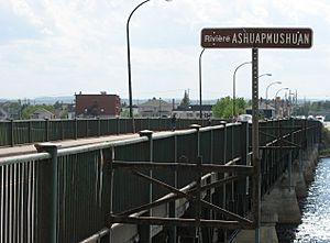
- Lower Ashuapmushuan River: This final section is about 37.6 kilometres (23.4 mi) (23.4 miles) long. The river forms loops and passes through more rapids, including the Little Bear Falls and Big Bear Falls. It is joined by the Rivière aux Saumons and the Petite rivière Eusèbe. It flows past the town of Saint-Félicien and finally widens before reaching its mouth.
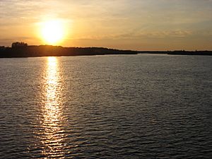
The river eventually flows into Lac Saint-Jean near Saint-Prime. From Lac Saint-Jean, the water continues into the Saguenay River and then into the Estuary of Saint Lawrence at Tadoussac.
The Ashuapmushuan River flows through several towns and areas. Starting from its source, it crosses:
| Left bank | Right Bank |
|---|---|
| Lac-Ashuapmushuan | Lac-Ashuapmushuan |
| La Doré | Rivière-Mistassini |
| Saint-Félicien | Saint-Thomas-Didyme |
| Saint-Prime | Normandin |
| Saint-Félicien |
For a large part of its path, the river acts as a border. It separates the Maria-Chapdelaine Regional County Municipality (on the north side) from the Le Domaine-du-Roy Regional County Municipality (on the south side).
History of the Ashuapmushuan River
The Ashuapmushuan River area has a long history. Many archaeological sites show that Indigenous people lived here for thousands of years. European explorers and missionaries arrived in the 1600s. For example, Charles Albanel used this river in 1672 during his journey to Hudson Bay.
In 1685, French fur traders set up a trading post on the eastern shore of Ashuapmushuan Lake. This post was used almost continuously until the mid-1800s. It was controlled by different groups over time, including the French, the British, the North West Company, and the Hudson's Bay Company. The river became a very important route for the fur trade, connecting Tadoussac to Hudson Bay. This was because its source is close to Lake Mistassini on the Rupert River. The remains of this old trading post are considered very important historical sites.
After the fur trade ended, the Ashuapmushuan River was used by logging companies. They would float logs downstream, a process called log driving, to transport timber.
Animals in the River
The Ashuapmushuan River and its smaller rivers are important places for landlocked salmon (a type of salmon that lives in fresh water). These salmon lay their eggs here, and it's where young salmon grow up. Baby salmon stay in the river for 2 to 4 years. After that, they swim to Lac Saint-Jean where they live most of their adult lives. When they are 4 to 8 years old, they return to the river to lay their own eggs.
While the Ashuapmushuan River has been very important for the salmon population in the lake, the number of salmon started to drop sharply in the 1990s. Even with efforts to protect them, the salmon population is still a concern.
 | May Edward Chinn |
 | Rebecca Cole |
 | Alexa Canady |
 | Dorothy Lavinia Brown |


