Chimney Rock (Canada) facts for kids
Quick facts for kids Chimney Rock |
|
|---|---|

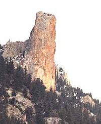
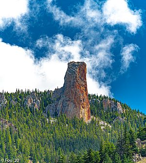
Chimney Rock from the northwest
|
|
| Highest point | |
| Elevation | 1,725 m (5,659 ft) |
| Prominence | 45 m (148 ft) |
| Listing | Mountains of British Columbia |
| Geography | |
| Location | British Columbia, Canada |
| Parent range | Marble Range |
| Topo map | NTS 92I13 Pavilion |
| Climbing | |
| First ascent | 1957 Hank Mather; Elfida Pigou |
Chimney Rock is a tall, unique rock formation. It is made of a type of rock called limestone. You can find it in Marble Canyon, British Columbia, Canada. This amazing rock stands proudly within Marble Canyon Provincial Park. It is located about halfway between the towns of Lillooet and Cache Creek.
Contents
What is Chimney Rock?
Chimney Rock gets its name because it looks like a tall chimney. It is a natural rock pillar. This formation is part of the Marble Range mountains. The rock is made of limestone, which is a common type of sedimentary rock.
Where is Chimney Rock Located?
Chimney Rock is in the beautiful province of British Columbia, Canada. It is specifically found in a place called Marble Canyon. This canyon is a scenic area. It is part of the larger Interior Plateau region of British Columbia. The rock is a highlight of Marble Canyon Provincial Park.
How Was Chimney Rock Formed?
Chimney Rock was formed over millions of years. Limestone rock is usually created from the shells and skeletons of tiny sea creatures. These creatures lived in ancient oceans. Over time, these materials piled up and hardened into rock. Then, wind, water, and ice slowly eroded the surrounding rock. This left behind the harder, more resistant pillar that we see today. This process is called weathering and erosion.
Exploring Marble Canyon Provincial Park
Marble Canyon Provincial Park is a great place to visit. It protects the unique landscape around Chimney Rock. The park offers stunning views of the canyon and its rock formations. It is a popular spot for outdoor activities. You can enjoy hiking and exploring the natural beauty. The park is also home to various plants and animals.
Who First Climbed Chimney Rock?
Climbing Chimney Rock is a challenging adventure. The first recorded climb happened in 1957. Two people, Hank Mather and Elfida Pigou, were the first to reach the top. This was a significant achievement. It showed their skill and determination.
 | William M. Jackson |
 | Juan E. Gilbert |
 | Neil deGrasse Tyson |


