Cilegon facts for kids
Quick facts for kids
Cilegon
|
|||
|---|---|---|---|
| City of Cilegon Kota Cilegon |
|||
| Name transcription(s) | |||
| • Sundanese | ᮎᮤᮜᮨᮌᮧᮔ᮪ | ||

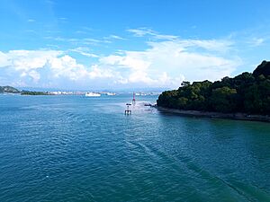
View of Cilegon from the Java Sea
|
|||
|
|||
| Nickname(s):
Steel City
|
|||
| Motto(s):
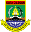
Akur Sedulur Jujur Adil Makmur
(Get along with fellows; honest, fair, and prosperous) |
|||

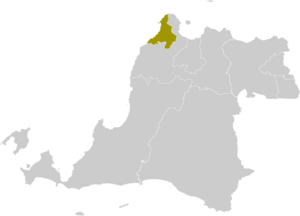
Location within Banten
|
|||
| Country | |||
| Region | Java | ||
| Province | |||
| Administrative City | 1987 | ||
| Municipality | 27 April 1999 | ||
| City | 4 September 1999 | ||
| Area | |||
| • Total | 162.51 km2 (62.75 sq mi) | ||
| Population
(mid 2023 estimate)
|
|||
| • Total | 450,507 | ||
| • Density | 2,772.18/km2 (7,179.91/sq mi) | ||
| Time zone | UTC+7 (Indonesia Western Time) | ||
| Postcodes |
42400
|
||
| Area code | (+62) 254 | ||
Cilegon is an important city in Banten province, Indonesia. It is located right on the coast of the island of Java. The city covers an area of about 162.51 square kilometers.
Cilegon is often called the "Steel City." This is because it's a huge producer of steel in Southeast Asia. Factories like Krakatau Steel make millions of tons of steel every year. This steel is used for many things, both in Indonesia and other countries.
Besides steel, Cilegon has other important places. These include the Merak Harbour, which is a busy port. There are also many industrial zones and power plants. These places are very important for Indonesia's economy.
Contents
Where is Cilegon Located?
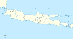
Cilegon is on the northwest coast of Java island. It sits at the mouth of the Cilegon River, which flows into Ciwandan Bay. This bay is part of the Sunda Strait.
The city is almost completely surrounded by Serang Regency. It borders Serang Regency to the east and south. To the north and west, it meets the Sunda Strait.
How Many People Live in Cilegon?
Cilegon has a growing population. In 2010, about 374,464 people lived there. By 2020, this number grew to 434,896. As of mid-2023, the city's population was estimated to be around 450,507 people.
The city is divided into eight main areas called districts (kecamatan). Each district has several smaller areas called villages (kelurahan).
What is Cilegon's Weather Like?
Cilegon has a hot and humid climate. It's like a tropical rainforest or tropical monsoon climate. This means it's warm all year round.
The city has clear wet and dry seasons. The wet season lasts from October to May, with lots of rain. January is usually the wettest month. The dry season is shorter, from June to September. August is the driest month.
| Climate data for Cilegon | |||||||||||||
|---|---|---|---|---|---|---|---|---|---|---|---|---|---|
| Month | Jan | Feb | Mar | Apr | May | Jun | Jul | Aug | Sep | Oct | Nov | Dec | Year |
| Mean daily maximum °C (°F) | 30.6 (87.1) |
31.1 (88.0) |
31.6 (88.9) |
32.2 (90.0) |
32.5 (90.5) |
32.4 (90.3) |
32.4 (90.3) |
32.4 (90.3) |
32.8 (91.0) |
33.0 (91.4) |
32.6 (90.7) |
31.8 (89.2) |
32.1 (89.8) |
| Daily mean °C (°F) | 26.6 (79.9) |
26.9 (80.4) |
27.2 (81.0) |
27.5 (81.5) |
27.7 (81.9) |
27.4 (81.3) |
27.1 (80.8) |
27.0 (80.6) |
27.4 (81.3) |
27.8 (82.0) |
27.7 (81.9) |
27.4 (81.3) |
27.3 (81.2) |
| Mean daily minimum °C (°F) | 22.7 (72.9) |
22.8 (73.0) |
22.8 (73.0) |
22.9 (73.2) |
23.0 (73.4) |
22.4 (72.3) |
21.9 (71.4) |
21.7 (71.1) |
22.1 (71.8) |
22.6 (72.7) |
22.9 (73.2) |
23.0 (73.4) |
22.6 (72.6) |
| Average rainfall mm (inches) | 319 (12.6) |
269 (10.6) |
209 (8.2) |
157 (6.2) |
129 (5.1) |
94 (3.7) |
80 (3.1) |
71 (2.8) |
73 (2.9) |
116 (4.6) |
169 (6.7) |
240 (9.4) |
1,926 (75.9) |
| Source: Climate-Data.org | |||||||||||||
Media and Communication
Cilegon has its own local media to keep people informed and entertained.
Newspaper
- Radar Banten (part of Jawa Pos)
Radio
- 91.8 Top FM Cilegon
- 95.3 FM Banten Radio
- 96.9 FM Sam Radio
- 102.0 Cilegon Mandiri FM (Local Government Broadcast)
- 105.2 Cilegon Pass FM
- 107.7 Gema Suara Tercinta
- 107.9 Flash Radio FM
Education
Cilegon has several schools for students.
- SMP Negeri 1
- SMPIT Raudhatul Jannah Cilegon
 | Jewel Prestage |
 | Ella Baker |
 | Fannie Lou Hamer |


