Cimarron River (Canadian River tributary) facts for kids
Quick facts for kids Cimarron River |
|
|---|---|

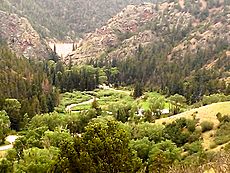
A view of the Cimarron River as it leaves Eagle Nest Dam
|
|
| Physical characteristics | |
| Main source | 8,146 ft (2,483 m) 36°31′49″N 105°13′41″W / 36.53028°N 105.22806°W |
| River mouth | Confluence with Canadian 5,679 ft (1,731 m) 36°19′27″N 104°29′58″W / 36.32417°N 104.49944°W |
| Length | 60 mi (97 km) |
| Basin features | |
| Progression | Canadian—Arkansas—Mississippi |
The Cimarron River is a cool river found entirely in New Mexico. It was once called La Flecha (which means "the arrow") or Semarone. This river starts from small streams like Moreno, Sixmile, and Cieneguilla creeks. These streams are in the Sangre de Cristo Mountains. They all flow into Eagle Nest Dam.
From the dam, the Cimarron River travels about 60 miles (97 km). It flows past the city of Springer, New Mexico. Finally, it joins the Canadian River. The Canadian River then flows into the Arkansas River, which eventually reaches the huge Mississippi River.
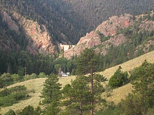
The Cimarron River flows through a beautiful mountain canyon. This area is part of Cimarron Canyon State Park. It starts in the lower Sangre de Cristo Mountains. Then it runs down into the flat eastern plains of New Mexico. The area where the river begins is also home to the famous Philmont Scout Ranch.
Contents
What Does "Cimarron" Mean?
The name "Cimarron" was first used for this river or the mountains nearby. Most people think it was named after the Rocky Mountain bighorn sheep. These sheep were called carnero cimarrnó in Spanish. The word cimarrónes was also used for wild cattle and horses.
Another idea is that the river was named after a wild rose plant. This plant, called rosa cimarróna, grows along the riverbanks. But in 1719, the river was called La Flecha. This means "the arrow" in Spanish. It might refer to a mountain pass called Palo Flechado Pass.
How the Cimarron River Helps Farmers
The Cimarron River is very important for local farmers and ranchers. It helps move water from the Moreno Valley. This water comes from Eagle Nest Lake. Farmers and ranchers downstream use this water for their crops and animals. They have special rights to use this water.
There are several places along the river where water is taken out. This water is then moved into canals and ditches. Three big groups help manage this water for farming. These are the Springer Ditch Company, Antelope Valley Irrigation District, and Vermejo Conservancy District. Some of this water travels as far as 50 miles (80 km) to where it is needed.
Weather Around the Cimarron River
| Climate data for Cimarron | |||||||||||||
|---|---|---|---|---|---|---|---|---|---|---|---|---|---|
| Month | Jan | Feb | Mar | Apr | May | Jun | Jul | Aug | Sep | Oct | Nov | Dec | Year |
| Mean daily maximum °F (°C) | 47 (8) |
51 (11) |
56 (13) |
63 (17) |
72 (22) |
81 (27) |
84 (29) |
81 (27) |
77 (25) |
68 (20) |
55 (13) |
49 (9) |
65 (18) |
| Mean daily minimum °F (°C) | 16 (−9) |
19 (−7) |
25 (−4) |
31 (−1) |
39 (4) |
48 (9) |
52 (11) |
51 (11) |
44 (7) |
33 (1) |
23 (−5) |
17 (−8) |
33 (1) |
| Average precipitation inches (mm) | 0.3 (7.6) |
0.3 (7.6) |
0.6 (15) |
1.7 (43) |
2.3 (58) |
1.4 (36) |
3.3 (84) |
2.6 (66) |
0.9 (23) |
1.1 (28) |
0.5 (13) |
0.4 (10) |
15.5 (390) |
The weather in the Cimarron area changes a lot throughout the year. Summers are warm, with temperatures often reaching the 80s Fahrenheit (around 27-30°C). Winters are cold, with lows in the teens Fahrenheit (around -10°C).
The area gets most of its rain in the summer months. July usually has the most rainfall. The spring months, like April and May, also get a good amount of rain.
Fun Things to Do and See
Cimarron Canyon State Park

Cimarron Canyon State Park is a great place to visit. It is located right along the Cimarron River. Here, you can go horseback riding or hiking on the trails. It's also a popular spot for fly-fishing. Many people enjoy camping there too.
The park is part of the Colin Neblett Wildlife Management Area. It is close to Angel Fire, New Mexico. You can find it along the beautiful Enchanted Circle Scenic Byway.
Fishing for Trout
The first 12 miles (19 km) of the Cimarron River are famous for excellent trout fishing. This part of the river runs from Eagle Nest Lake to Ute Park, New Mexico. You can catch different kinds of trout here. These include rainbow trout and brown trout.
The New Mexico Department of Game and Fish works hard to keep the river full of fish. They try to have about 3,000 trout per mile. The amount of water flowing in the river can change a lot. It can be anywhere from 2 to 50 cubic feet per second.
Wildlife You Might See
Many different animals live around the Cimarron River. You will often see deer, beavers, mice, squirrels, rabbits, and chipmunks. Swallows are also common birds in the area. Sometimes, you might even spot bigger animals. These include mountain lions, coyotes, and black bears.
 | William L. Dawson |
 | W. E. B. Du Bois |
 | Harry Belafonte |

