Clarksville, Albany County, New York facts for kids
Quick facts for kids
Clarksville
|
|
|---|---|
| Country | United States |
| State | New York |
| County | Albany |
| Town | Town of New Scotland |
| Area | |
| • Total | 2.7 sq mi (7 km2) |
| Elevation | 663 ft (202 m) |
| Population
(2014)For ZIP Code 12041
|
|
| • Total | 153 |
| • Density | 56.7/sq mi (21.9/km2) |
| Time zone | UTC-5 (Eastern (EST)) |
| • Summer (DST) | UTC-4 (EDT) |
| ZIP code |
12041
|
| Area code(s) | 518 |
| GNIS feature ID | 946794 |
| FIPS code | 36-15979 |
| Formerly | West Bethlehem |
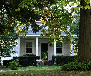
Clarksville is a small community known as a hamlet in New York. It is located in the town of New Scotland, which is part of Albany County. You can find Clarksville along the Delaware Turnpike (New York State Route 443) in the southern part of the town. It sits right at the bottom of the Helderberg Escarpment, a cool natural rock formation. Clarksville is also home to the famous Clarksville Cave and hosts a fun annual Clarksville Heritage Day and Car Show.
Contents
History of Clarksville
In 1805, a major road called the Albany and Delaware Turnpike was built right through the area that would later become Clarksville. Because this spot was exactly halfway between Albany and Rensselaerville, it quickly became a popular stopping point for travelers. Soon, many inns, taverns, and other businesses opened up to serve them.
Clarksville was first part of the town of Bethlehem and even had its post office there. Later, when the town of New Scotland was created, the post office and the hamlet were named Clarksville. This name honored Adam A. Clark, who moved to the area in 1822.
By 1853, the Reformed Church of Clarksville was built, and a Methodist church followed in 1860-1861. In 1854, a special road made of planks was built from Clarksville. It went north and east to Feura Bush and Bethlehem Center, connecting to another main road to Albany. Clarksville used to be the biggest settlement in New Scotland. However, in the late 1800s, many railroads came together in Voorheesville, causing that part of town to grow much faster.
Geography and Nature
Clarksville is located in the southern part of the town of New Scotland. It's along the Delaware Turnpike (New York State Route 443), just east of the Helderberg Escarpment. This escarpment is a steep slope or cliff that forms a natural boundary. Albany County Route 301 goes south from Clarksville to Tarrytown. Route 443 heads east to Unionville and west to the town of Berne. The Onesquethaw Creek flows east along the south side of Route 443.
The area covered by the Clarksville ZIP Code (12041) looks a bit like a triangle. Stove Pipe Road forms the western side, and Upper Flat Rock Road is the eastern side. Bennett Hill Road and Plank Road make up the southern base of this triangle.
South and west of the hamlet, Bennett Hill rises about 400 feet higher than Clarksville. The top of this hill is a flat area called a plateau, averaging 1120 feet above sea level. Its highest point is 1135 feet. This hill is part of a wild area protected by the Mohawk Hudson Land Conservancy.
Clarksville Cave
Clarksville Cave is a really cool natural feature with three entrances and about 4,800 feet (over 1,400 meters) of underground passages. The Northeastern Cave Conservancy Inc. owns the cave, and it's open to the public. It's one of the most used non-commercial cave systems in the United States. The cave was first found in the 1800s. For a long time, anyone could explore it. But in 2004, the conservancy bought two of the entrances and started managing how people access it to keep it safe and protected.
Where Clarksville Is
 |
Hamlet of New Salem Vly Creek Reservoir |
Hamlet of Unionville |  |
|
| Town of Berne | Hamlet of Feura Bush | |||
| Hamlet of Tarrytown |
Culture and Events
Clarksville has a special annual event called the Clarksville Heritage Day and Car Show. It takes place on the first Saturday of August each year. The Clarksville Historical Society helps organize and sponsor this fun event.
Education for Students
Children living in Clarksville attend schools within the Bethlehem Central School District (BCSD). For kindergarten through fifth grade, students go to either Slingerlands or Eagle Elementary Schools. After elementary school, they move on to Bethlehem Central Middle School and then Bethlehem Central High School for sixth through twelfth grade.
Historic Buildings
- Clarksville Elementary School is a building with a lot of history. It is listed on the National Register of Historic Places, which means it's recognized as an important historical site. The school closed after the 2010–2011 school year. Today, the building is used by the Albany County Sheriff's Uniform Patrol Division.
Notable Person
- Edwin Corning Jr. was a well-known person from Clarksville. He was the son of Edwin Corning and the brother of Erastus Corning 2nd. Edwin Corning Jr. also served as a member of the New York State Assembly, which is part of the state's government.
 | John T. Biggers |
 | Thomas Blackshear |
 | Mark Bradford |
 | Beverly Buchanan |


