Helderberg Escarpment facts for kids
Quick facts for kids Helderberg Escarpment |
|
|---|---|
| Highest point | |
| Elevation | 1,197 feet (365 m) |
| Geography | |
| Location | SSE of Altamont, New York, U.S. |
| Topo map | USGS Westerlo, Clarksville, Voorheesville, Alcove, Altamont |
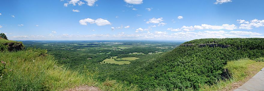
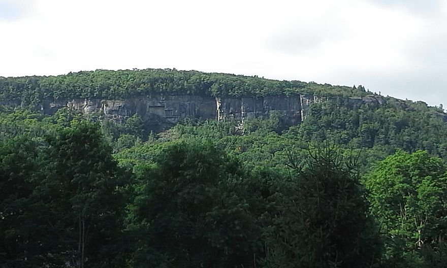
The Helderberg Escarpment, also known as the Helderberg Mountains, is a huge natural cliff and mountain range. It is located in eastern New York, United States. This amazing landform is about 11 miles (18 km) west of the city of Albany.
The escarpment rises very steeply from the Hudson Valley below. The height difference is about 700 feet (213 meters) over a short distance. Much of this area is inside John Boyd Thacher State Park. From here, you can see fantastic views of the Hudson Valley and the Albany area.
Geology of the Helderberg Escarpment
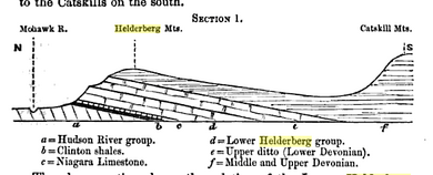
The Helderberg Escarpment is a type of landform called an escarpment. It is like a cousin to other large cliffs in North America. These include the Niagara Escarpment and the Black River Escarpment.
The rocks you can see in the escarpment are very old. They formed between the Middle Ordovician and Early Devonian periods. This means they are hundreds of millions of years old!
In 1934, a newspaper called the Schenectady Gazette wrote about Tory Cave. This is one of the many limestone caves found in the escarpment. The newspaper said that ice stalagmites often formed inside the cave during springtime.
Transmission Towers on the Escarpment
Many television stations in the Capital District area use the Helderberg Escarpment. They built their transmission towers here because it is very high ground. This helps their signals travel far.
In 2003, a very tall tower was built on the highest point of the escarpment. This tower is 499 feet (152 meters) tall. It helps send out digital television signals to many homes.
History of the Helderberg Area
Dutch settlers were some of the first Europeans to live on the plateau above the escarpment. This happened in the 1600s. The name "Helderberg" comes from the Dutch language. It means "clear mountain."
Today, groups like the Open Space Institute and the Mohawk Hudson Land Conservancy are working to protect the land. They want to stop the escarpment lands from being used for new houses or factories.
Farmers who own land near the escarpment can help protect it too. They can choose to sell their "development rights." This means they get paid to agree that their land will always be used for farming. It helps make sure the land is not turned into buildings.
For example, in 2003, the Ten Eyck family sold the development rights for their Indian Ladder Farm. This farm is just below the escarpment. They received $848,000 for this agreement. This was the first time property owners in Albany County sold their development rights.
 | George Robert Carruthers |
 | Patricia Bath |
 | Jan Ernst Matzeliger |
 | Alexander Miles |


