Clarkton, North Carolina facts for kids
Quick facts for kids
Clarkton, North Carolina
|
|
|---|---|

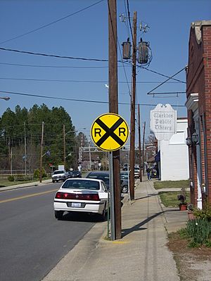
A view of downtown Clarkton
|
|

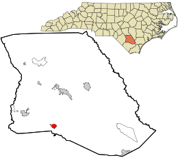
Location in Bladen County and the state of North Carolina.
|
|
| Country | United States |
| State | North Carolina |
| County | Bladen |
| Area | |
| • Total | 1.25 sq mi (3.24 km2) |
| • Land | 1.25 sq mi (3.23 km2) |
| • Water | 0.01 sq mi (0.02 km2) |
| Elevation | 85 ft (26 m) |
| Population
(2020)
|
|
| • Total | 614 |
| • Density | 492.78/sq mi (190.31/km2) |
| Time zone | UTC-5 (Eastern (EST)) |
| • Summer (DST) | UTC-4 (EDT) |
| ZIP code |
28433
|
| Area codes | 910, 472 |
| FIPS code | 37-12780 |
| GNIS feature ID | 2406272 |
Clarkton is a small town in Bladen County, North Carolina, United States. In 2020, about 614 people lived there. It is a quiet place with a rich history.
Contents
History
Clarkton has some important historical buildings. These buildings are special because they are listed on the National Register of Historic Places. This means they are protected because of their history.
Some of these buildings include:
- The Brown Marsh Presbyterian Church
- The John Hector Clark House
- The Clarkton Depot
A famous person from Clarkton was James C. "Jimmy" Green. He was once the Lieutenant Governor of North Carolina. A Lieutenant Governor is like a vice-president for a state. They help the Governor lead the state.
Geography
Clarkton is easy to find because it sits where two main roads meet. These roads are North Carolina Highway 211 and U.S. Route 701.
The town is about 11 miles (18 km) south of Elizabethtown. The Cape Fear River is also nearby. The closest town to Clarkton is Bladenboro, which is about 8 miles (13 km) to the west.
A train track also runs through Clarkton. It is part of the CSX Railroad system. This track runs next to North and South Railroad Streets in town.
Clarkton is in an area called the Carolina Border Belt. This area is known for its tobacco farms and markets. Farmers used to bring their tobacco here to sell it.
The town covers a total area of about 1.25 square miles (3.2 square kilometers). Only a very small part of this area is water.
Demographics
| Historical population | |||
|---|---|---|---|
| Census | Pop. | %± | |
| 1910 | 276 | — | |
| 1920 | 368 | 33.3% | |
| 1930 | 458 | 24.5% | |
| 1940 | 484 | 5.7% | |
| 1950 | 589 | 21.7% | |
| 1960 | 662 | 12.4% | |
| 1970 | 662 | 0.0% | |
| 1980 | 664 | 0.3% | |
| 1990 | 739 | 11.3% | |
| 2000 | 705 | −4.6% | |
| 2010 | 837 | 18.7% | |
| 2020 | 614 | −26.6% | |
| U.S. Decennial Census | |||
In 2000, there were 705 people living in Clarkton. These people lived in 285 different homes. About 176 of these were families.
The town has a mix of people from different backgrounds. Most households had about 2 to 3 people living in them.
About 25% of the people in Clarkton were under 18 years old. About 16% were 65 years old or older. The average age of people in Clarkton was 41 years. This means the town has a good mix of younger and older residents.
See also
 In Spanish: Clarkton (Carolina del Norte) para niños
 | Sharif Bey |
 | Hale Woodruff |
 | Richmond Barthé |
 | Purvis Young |

