
Bladen County, North Carolina facts for kids
Quick facts for kids
Bladen County
|
|||
|---|---|---|---|

Bladen County Courthouse
|
|||
|
|||
| Nickname(s):
The Mother County
|
|||
| Motto(s):
"In God We Trust"
|
|||

Location within the U.S. state of North Carolina
|
|||
 North Carolina's location within the U.S. |
|||
| Country | |||
| State | |||
| Founded | 1734 | ||
| Named for | Martin Bladen | ||
| Seat | Elizabethtown | ||
| Largest community | Elizabethtown | ||
| Area | |||
| • Total | 887.78 sq mi (2,299.3 km2) | ||
| • Land | 875.03 sq mi (2,266.3 km2) | ||
| • Water | 12.75 sq mi (33.0 km2) 1.44% | ||
| Population
(2020)
|
|||
| • Total | 29,606 | ||
| • Estimate
(2023)
|
29,484 | ||
| • Density | 33.83/sq mi (13.06/km2) | ||
| Time zone | UTC−5 (Eastern) | ||
| • Summer (DST) | UTC−4 (EDT) | ||
| Congressional district | 7th | ||


Bladen County is a place in North Carolina, a state in the United States. In 2020, about 29,606 people lived there. The main town, or county seat, is Elizabethtown. Bladen County started as a "precinct" in 1734 and became a full county in 1739.
Contents
What is the History of Bladen County?
Bladen County was first created in 1734. It was called Bladen Precinct and was part of Bath County. It was formed from New Hanover Precinct. The county was named after Martin Bladen, who was an important member of the Board of Trade. When Bath County was removed in 1739, Bladen Precinct officially became a county.
Who Lived in Bladen County First?
The first people to live in the Bladen County area were the Waccamaw people. They were Native Americans who lived there long before the county was formed.
How Did Bladen County Change Over Time?
Bladen County used to be much, much bigger! It had no clear northern or western borders at first. Over many years, parts of Bladen County were used to create other counties. This started in 1750 when Anson County was formed from its western part.
More changes happened:
- In 1754, Cumberland County was created from the northern part.
- In 1764, parts of Bladen and New Hanover County formed Brunswick County.
- In 1787, Robeson County was created from the western part of Bladen.
- Finally, in 1808, Columbus County was formed from the southern part of Bladen and part of Brunswick County.
Because so many other counties were once part of Bladen, it is often called the "mother county" of North Carolina. Out of the 100 counties in the state today, 55 of them were once part of Bladen County!
What is the Geography of Bladen County?
Bladen County covers a total area of about 887.78 square miles. Most of this area, about 874.03 square miles, is land. The rest, about 12.75 square miles, is water. This makes Bladen County the fourth-largest county in North Carolina by land area.
What are the Protected Natural Areas?
Bladen County has several important natural areas and parks. These places help protect the environment and offer outdoor activities. Some of them include:
- Bakers Lake State Natural Area
- Bay Tree Lake State Natural Area
- Bladen Lakes State Forest
- Jones Lake State Park
- Singletary Lake State Park
- Turnbull Creek Educational State Forest
- White State Lake
What are the Major Rivers and Lakes?
Bladen County has many important water bodies.
- Bay Tree Lake
- Black River: This river is special because it is home to some of the oldest bald cypress trees in the world! Some are over 2,600 years old.
- Cape Fear River
- Jones Lake
- Singletary Lake
- White Lake
Which Counties are Next to Bladen County?
Bladen County shares its borders with several other counties:
- Cumberland County to the north
- Sampson County to the northeast
- Pender County to the east
- Columbus County to the south
- Robeson County to the west
What are the Main Roads?
Many important highways run through Bladen County. These roads help people travel and transport goods. Some of the main highways include:
 US 701
 NC 11
NC 11 NC 87
NC 87 NC 211
What Other Important Structures are There?
- Curtis L. Brown Jr. Field: This is a local airport.
- Elwell Ferry: This is a special ferry that crosses the Cape Fear River.
What is the Climate Like?
Bladen County has a humid subtropical climate. This means it usually has mild temperatures all year round.
How Warm or Cold Does it Get?
Winters in Bladen County are generally mild. The warmest winter temperatures are found in the southeastern parts of the county. In January, the average high temperature is around 55 °F (13 °C).
Summers are hot and humid. The hottest summer temperatures are usually in the northern and western areas. In July, the average high temperature is around 90 °F (32 °C).
Have There Been Extreme Temperatures?
While not common, Bladen County can experience very extreme temperatures:
- In December 1989, the temperature dropped to -3 °F (-19 °C) in Elizabethtown. This was a record low.
- In August 2007, Elizabethtown reached a record high of 105 °F (41 °C).
Does it Snow in Bladen County?
Snow is rare in Bladen County, just like in many other parts of eastern North Carolina. On average, light snow falls only once or twice every 10 years.
What About the People of Bladen County?
How Many People Live Here?
According to the 2020 census, 29,606 people lived in Bladen County.
- About 54.4 percent of residents were white.
- About 32.3 percent were black.
- About 2.7 percent were Native American.
- About 6.1 percent were from other groups.
- About 20.7 percent of people identified as Hispanic or Latino.
Has the Population Changed?
Between 2010 and 2020, the number of people living in Bladen County went down by about 15.9 percent. This means 5,584 fewer people lived there.
What About Education in Bladen County?
Colleges
- Bladen Community College is located in Dublin. It offers higher education programs.
Public Schools
The public schools in Bladen County are managed by Bladen County Schools.
What About Healthcare?
Bladen County has one hospital, Cape Fear Valley Medical Center, located in Elizabethtown. In 2022, Bladen County ranked 85th out of North Carolina's 100 counties for health outcomes. This was an improvement from previous years. About 26 percent of adults say they are in poor or fair health. The average life expectancy in the county is 75 years.
What is the Economy Like?
Farming is a very important part of Bladen County's economy.
What are the Main Industries?
- Agriculture: Bladen County is the largest producer of blueberries in North Carolina. Farmers also grow crops like soybeans, peanuts, corn, wheat, and cotton.
- Pork Processing: Smithfield Foods has a very large pork processing plant near Tar Heel. It is the biggest plant of its kind in the world! It employs 5,800 workers, making it the largest employer in the county.
What are the Economic Challenges?
Bladen County faces some economic challenges. It has a high poverty rate and is considered one of the most economically struggling counties in the state. About 70 percent of working people in Bladen County travel outside the county for their jobs.
What are the Communities in Bladen County?


Towns
- Bladenboro
- Clarkton
- Dublin
- East Arcadia
- Elizabethtown (This is the county seat and the largest community.)
- Tar Heel
- White Lake
Census-Designated Places (CDPs)
These are areas that are like towns but are not officially incorporated as towns.
Unincorporated Communities
These are smaller places that are not part of any town or CDP.
- Abbottsburg
- Ammon
- Carvers
- Council
- Emerson
- Rosindale
- Rowan
- Westbrook
How Do Communities Rank by Population?
Here is a list of the largest communities in Bladen County, based on the 2020 census:
| Rank | Name | Type | Population (2020 census) |
|---|---|---|---|
| 1 | † Elizabethtown | Town | 3,296 |
| 2 | Bladenboro | Town | 1,648 |
| 3 | White Lake | Town | 843 |
| 4 | Clarkton | Town | 614 |
| 5 | Kelly | CDP | 446 |
| 6 | East Arcadia | Town | 418 |
| 7 | White Oak | CDP | 346 |
| 8 | Dublin | Town | 267 |
| 9 | Butters | CDP | 250 |
| 10 | Tar Heel | Town | 90 |
Images for kids
-
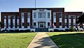
Bladen County Courthouse
-
Bladen County Seal
-
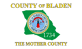
Bladen County Flag
See also
 In Spanish: Condado de Bladen para niños
