
Anson County, North Carolina facts for kids
Quick facts for kids
Anson County
|
|||
|---|---|---|---|

Anson County Courthouse and Confederate Monument in Wadesboro
|
|||
|
|||
| Motto(s):
"Anson County - A great place to call home"
|
|||

Location within the U.S. state of North Carolina
|
|||
 North Carolina's location within the U.S. |
|||
| Country | |||
| State | |||
| Founded | 1750 | ||
| Named for | George Anson, Baron Anson | ||
| Seat | Wadesboro | ||
| Largest community | Wadesboro | ||
| Area | |||
| • Total | 537.10 sq mi (1,391.1 km2) | ||
| • Land | 531.46 sq mi (1,376.5 km2) | ||
| • Water | 5.64 sq mi (14.6 km2) 1.05% | ||
| Population
(2020)
|
|||
| • Total | 22,055 | ||
| • Estimate
(2023)
|
21,897 | ||
| • Density | 41.50/sq mi (16.02/km2) | ||
| Time zone | UTC−5 (Eastern) | ||
| • Summer (DST) | UTC−4 (EDT) | ||
| Congressional district | 8th | ||


Anson County is a place in North Carolina, a state in the United States. It is a county, which is like a smaller region within a state. In 2020, about 22,055 people lived there. The main town and government center is Wadesboro.
Contents
History of Anson County
Anson County was first home to the Catawba Siouan tribe. It was a very large area with no clear northern or western borders.
The county was officially created in 1750. It was formed from a part of Bladen County. The county was named after George Anson, Baron Anson. He was a British admiral who sailed all the way around the world. Anson also bought land in North Carolina.
In 1783, a town called New Town became the county seat. Four years later, its name was changed to Wadesboro.
Over the years, Anson County became smaller. In 1753, its northern part became Rowan County. In 1762, the western part became Mecklenburg County. Later, in 1779, parts of Anson County became Montgomery County and Richmond County. Finally, in 1842, a western part of Anson County joined with part of Mecklenburg County to form Union County.
Geography of Anson County
Anson County covers about 537 square miles. Most of this area, about 531 square miles, is land. The rest, about 5.6 square miles, is water.
It shares borders with several other counties in North Carolina:
It also borders Chesterfield County in South Carolina.
Nature and Parks
Anson County has some special places for nature lovers:
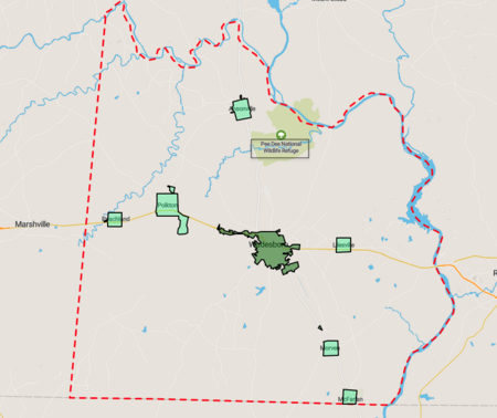
- Pee Dee National Wildlife Refuge: A protected area for wildlife.
- Arrowhead Lake: A beautiful lake.
- Gaddy Covered Bridge: A historic covered bridge.
- Pee Dee River Game Land: Another area for outdoor activities.
- Wadesboro Downtown Historic District: A historic part of Wadesboro.
Rivers and Lakes
The county has several important water bodies:
- Blewett Falls Lake
- Brown Creek
- Goulds Fork
- Great Pee Dee River
- Lanes Creek
- Rocky River
- Thoroughfare Creek
Transportation
Major roads like US 52 and US 74 run through Anson County. There is also the Anson County Airport.
People of Anson County
| Historical population | |||
|---|---|---|---|
| Census | Pop. | %± | |
| 1790 | 5,133 | — | |
| 1800 | 8,146 | 58.7% | |
| 1810 | 8,831 | 8.4% | |
| 1820 | 12,534 | 41.9% | |
| 1830 | 14,095 | 12.5% | |
| 1840 | 15,077 | 7.0% | |
| 1850 | 13,489 | −10.5% | |
| 1860 | 13,664 | 1.3% | |
| 1870 | 12,428 | −9.0% | |
| 1880 | 17,994 | 44.8% | |
| 1890 | 20,027 | 11.3% | |
| 1900 | 21,870 | 9.2% | |
| 1910 | 25,465 | 16.4% | |
| 1920 | 28,334 | 11.3% | |
| 1930 | 29,349 | 3.6% | |
| 1940 | 28,443 | −3.1% | |
| 1950 | 26,781 | −5.8% | |
| 1960 | 24,962 | −6.8% | |
| 1970 | 23,488 | −5.9% | |
| 1980 | 25,649 | 9.2% | |
| 1990 | 23,474 | −8.5% | |
| 2000 | 25,275 | 7.7% | |
| 2010 | 26,948 | 6.6% | |
| 2020 | 22,055 | −18.2% | |
| 2023 (est.) | 21,897 | −18.7% | |
| U.S. Decennial Census 1790–1960 1900–1990 1990–2000 2010 2020 |
|||
The 2020 census counted 22,055 people living in Anson County. This included 9,521 households and 5,809 families.
Anson County is known as a majority minority county. This means that groups other than non-Hispanic White people make up more than half of the population. Between 2010 and 2020, the county's population decreased by about 18 percent.
In 2020, the population was made up of:
- About 48% White (non-Hispanic)
- About 44.6% Black or African American (non-Hispanic)
- About 1% Asian
- About 0.4% Native American
- About 3% Hispanic or Latino
- Other groups made up the rest.
Education in Anson County
The Anson County Schools system has 11 schools. These schools serve all the students in the county.
Students can also attend South Piedmont Community College. It has a campus located near Polkton.
Communities in Anson County
Towns
- Ansonville
- Lilesville
- McFarlan
- Morven
- Peachland
- Polkton
- Wadesboro (This is the county seat and the largest community.)
Unincorporated Communities
These are smaller places that are not officially towns:
Townships
Townships are smaller divisions of the county:
- Ansonville
- Burnsville
- Gulledge
- Lanesboro
- Lilesville
- Morven
- Wadesboro
- White Store
Ghost Town
Population Ranking of Towns
Here's how the towns in Anson County ranked by population in 2020:
| Rank | Name | Type | Population (2020 census) |
|---|---|---|---|
| 1 | † Wadesboro | Town | 5,008 |
| 2 | Polkton | Town | 2,250 |
| 3 | Ansonville | Town | 440 |
| 4 | Lilesville | Town | 395 |
| 5 | Peachland | Town | 390 |
| 6 | Morven | Town | 329 |
| 7 | McFarlan | Town | 94 |
Notable People from Anson County
Many interesting people have come from Anson County:
- Stephone Anthony (born 1992), a football player who was a linebacker for the New Orleans Saints in the NFL.
- Hugh Hammond Bennett (1881–1960), a specialist in protecting soil.
- John Culpepper (1761–1841), a United States Congressman from North Carolina and a Baptist minister.
- Blind Boy Fuller (1907–1941), a famous American blues guitarist and singer.
- James Holland (1754–1823), another United States Congressman from North Carolina.
- Juanita Moody (1924–2015), a cryptographer. Her intelligence work was very important during the Cuban Missile Crisis.
- Leonidas Lafayette Polk (1837–1892), the first person to be the North Carolina Commissioner of Agriculture.
- Sylvester Ritter (1952–1998), a professional wrestler known as "The Junkyard Dog" or "JYD".
- David Lutz (born 1959), a football player who was a tackle for the Kansas City Chiefs and Detroit Lions in the NFL.
See also
 In Spanish: Condado de Anson para niños
